Police Helicopter to Basingstoke, Crossborough Hill
Tuesday, 20 January 2026 | 16:46 | From Whitchurch
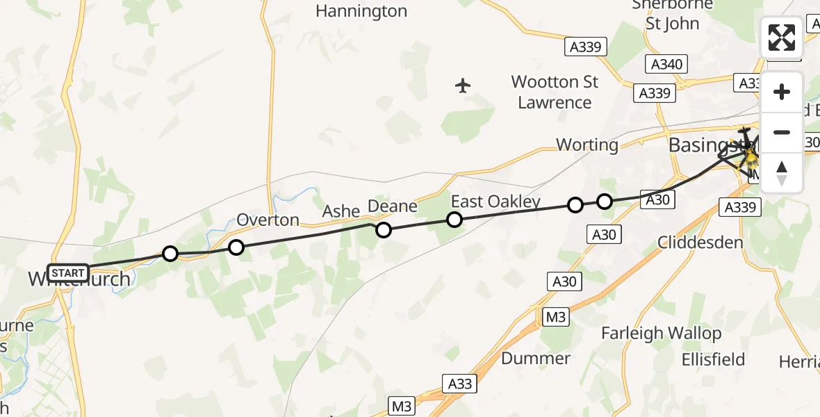
On Tuesday, 20 January 2026 at 16:46, a Police Helicopter departed from Whitchurch to Basingstoke. It was the Police Helicopter with registration number G-BZRS. The flight lasted 7 minutes. During that period, the aircraft travelled 14 miles at an average speed of 119 miles per hour at a maximum altitude of 1550 feet.
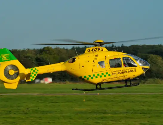
Helicopter: G-BZRS
The helicopter G-BZRS is used by the British police. The helicopter is deployed in pursuits, missing persons cases and other incidents where a helicopter provides added value.
Photo: NMOS332
14 miles
1550 feet
119 mph
7 minutes
16:46
16:52

Route
Crossborough Hill, Basingstoke and Deane16:52
Crossborough Hill, Basingstoke and Deane16:52
Anchor Yard, Basingstoke and Deane16:52
Council Road, Basingstoke and Deane16:52
Ringway South, Basingstoke and Deane16:51
Lennox Road, Basingstoke and Deane16:50
Basingstoke, Basingstoke and Deane16:50
Oakley, Basingstoke16:50
Oakley, Basingstoke and Deane16:49
Deane, Basingstoke and Deane16:48
Overton, Basingstoke and Deane16:47
Basingstoke and Deane16:46
Lower Evingar Road, Basingstoke and Deane16:46
Today
Flights Basingstoke
Air Ambulance Helicopter to Southampton Airport23 Jun 23:52
Police Helicopter to Basingstoke, Wayside Road21 Jun 14:22
Flights Whitchurch
Air Ambulance Helicopter to Whitchurch, Hillside12 Jun 21:45
Air Ambulance Helicopter to RAF Benson14 Apr 18:02
Helicopter flights on your website?
You can easily display helicopter flights on your own website. Use the embed code.
