Police Helicopter to Gosport
Tuesday, 20 January 2026 | 12:29 | From Hursley
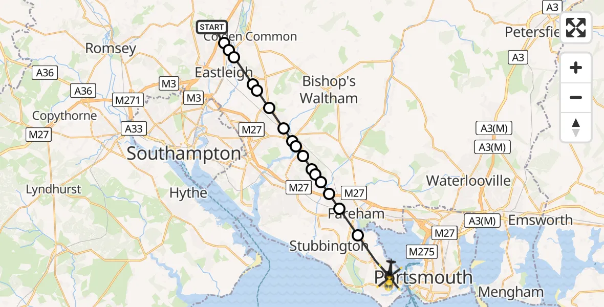
On Tuesday, 20 January 2026 at 12:29, a Police Helicopter departed from Hursley to Gosport. It was the Police Helicopter with registration number G-BZRS. The flight lasted 13 minutes. During that period, the aircraft travelled 22 miles at an average speed of 97 miles per hour at a maximum altitude of 1125 feet.
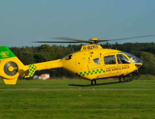
Helicopter: G-BZRS
The helicopter G-BZRS is used by the British police. The helicopter is deployed in pursuits, missing persons cases and other incidents where a helicopter provides added value.
Photo: NMOS332
22 miles
1125 feet
97 mph
14 minutes
12:29
12:43

Route
Gosport12:43
Gosport, 12:42
The Crossways, 12:42
Parham Road, 12:41
Forton Road, 12:41
Mill Lane, 12:40
Bevis Road, 12:40
Mill Lane, 12:39
Gosport12:37
Fareham12:36
Funtley, Fareham12:36
Knowle, Winchester12:35
Winchester12:35
Whiteley, Winchester12:35
Curbridge, Winchester12:34
Curdridge, Winchester12:34
Curbridge, Winchester12:34
Botley, Eastleigh12:33
Hedge End12:32
Horton Heath, Eastleigh12:32
Fair Oak, Eastleigh12:31
Bishopstoke, Eastleigh12:30
Highbridge, Eastleigh12:30
Allbrook, Eastleigh12:30
Hocombe Road, Winchester12:29
Live flights
Police Helicopter on its way from RAF Benson12 Jul 22:54
Police Helicopter on its way from Dundrod12 Jul 22:50
Police Helicopter on its way from East Ardsley12 Jul 22:44
Today
Air Ambulance Helicopter to Glasgow Airport12 Jul 22:48
Air Ambulance Helicopter to Norwich Airport12 Jul 22:27
Air Ambulance Helicopter to Northrepps Aerodrome12 Jul 22:23
Police Helicopter to Harborough, Sulby Road12 Jul 22:20
Air Ambulance Helicopter to Derriford Hospital12 Jul 22:12
Police Helicopter to Manchester Barton Aerodrome12 Jul 22:11
Air Ambulance Helicopter to Northrepps Aerodrome12 Jul 22:03
Flights Gosport
Air Ambulance Helicopter to Gosport, Rydal Road30 Jun 17:47
Air Ambulance Helicopter to Southampton Airport26 Jun 00:31
Flights Hursley
Police Helicopter to Gosport20 Jan 12:29
Police Helicopter to Hursley, Hunter's Ride18 Jan 23:18
Police Helicopter to Portsmouth, Cressy Road10 Jan 16:17
Helicopter flights on your website?
You can easily display helicopter flights on your own website. Use the embed code.
