Air Ambulance Helicopter to Nottingham Heliport
Tuesday, 20 January 2026 | 11:24 | From Shirebrook
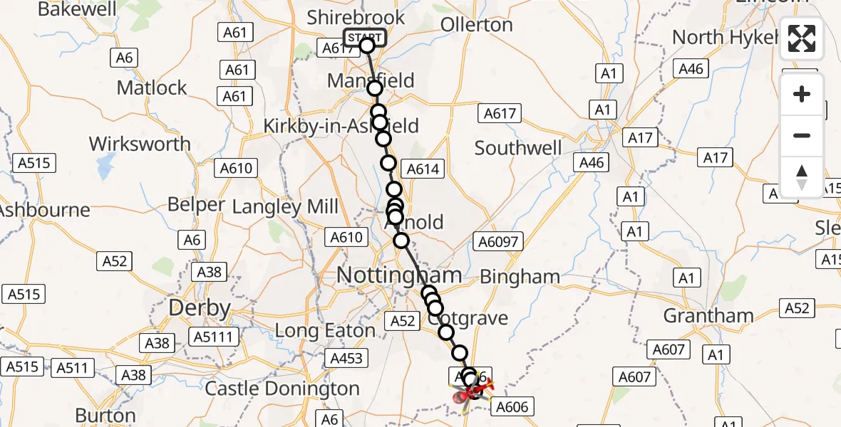
On Tuesday, 20 January 2026 at 11:24, a Air Ambulance Helicopter departed from Shirebrook to Nottingham Heliport. It was the Air Ambulance Helicopter with registration number G-DRLA. The flight lasted 12 minutes. During that period, the aircraft travelled 27 miles at an average speed of 135 miles per hour at a maximum altitude of 1475 feet.
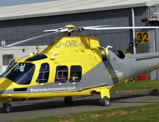
Helicopter: G-DRLA
The helicopter G-DRLA is used as an ambulance helicopter. The helicopter is equipped with a stretcher for transporting patients. The helicopter is often used to transport to hospitals.
Photo: Alec Wilson
27 miles
1475 feet
135 mph
12 minutes
11:24
11:36

Route
Nottingham Heliport, 11:36
Nottingham Heliport11:36
Hickling, Rushcliffe11:35
Widmerpool, Rushcliffe11:35
Stanton on the Wolds, Rushcliffe11:34
Normanton on the Wolds, Rushcliffe11:33
Tollerton, West Bridgford11:32
West Bridgford, Rushcliffe11:32
Holme Pierrepont, West Bridgford11:32
City of Nottingham, East Midlands11:30
Bulwell, City of Nottingham11:30
Arnold, City of Nottingham11:29
Bestwood Village, Arnold11:29
Bestwood Village, Gedling11:29
Papplewick CP, Gedling11:28
Ravenshead CP, Gedling11:27
Kirkby-in-Ashfield, East Midlands11:27
Kirkby-in-Ashfield, Ashfield11:26
Mansfield, East Midlands11:26
Mansfield Woodhouse, East Midlands11:24
Wood Lane, East Midlands11:24
Live flights
Today
Flights Shirebrook
Air Ambulance Helicopter to Nottingham Heliport21 Apr 10:54
Air Ambulance Helicopter to Nottingham Heliport20 Jan 11:24
Helicopter flights on your website?
You can easily display helicopter flights on your own website. Use the embed code.
