Police Helicopter to Whimple, A30
Monday, 19 January 2026 | 17:18 | From Rockbeare
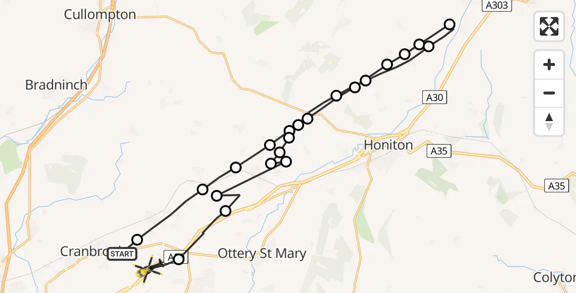
On Monday, 19 January 2026 at 17:18, a Police Helicopter departed from Rockbeare to Whimple. It was the Police Helicopter with registration number G-CPAS. The flight lasted 11 minutes. During that period, the aircraft travelled 27 miles at an average speed of 142 miles per hour at a maximum altitude of 2975 feet.
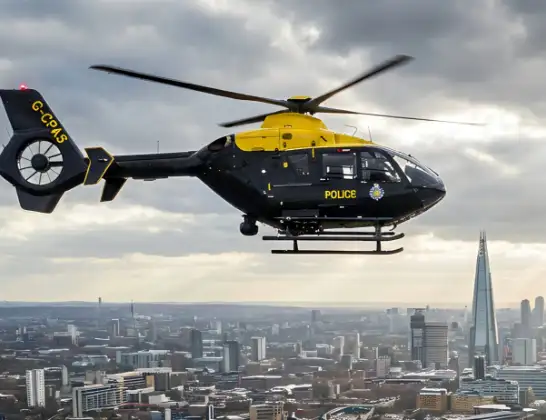
Helicopter: G-CPAS
The helicopter G-CPAS is used by the British police. The helicopter is deployed in pursuits, missing persons cases and other incidents where a helicopter provides added value.
Photo: Tony Melony
28 miles
2975 feet
142 mph
12 minutes
17:18
17:29

Route
A30, East Devon17:29
Whimple, East Devon17:29
Ottery St Mary, East Devon17:28
Talaton, East Devon17:27
Buckerell, East Devon17:27
Feniton, East Devon17:27
Fenny Bridges, East Devon17:27
East Devon, Devon and Torbay17:26
Buckerell, East Devon17:26
Awliscombe, East Devon17:25
Combe Raleigh, East Devon17:25
Beacon, East Devon17:24
Rawridge, East Devon17:23
Beacon, East Devon17:22
Luppitt, East Devon17:22
Beacon, East Devon17:22
Combe Raleigh, East Devon17:21
Awliscombe, East Devon17:21
East Devon, Devon and Torbay17:20
Payhembury, East Devon17:20
Feniton, East Devon17:20
Talaton, East Devon17:19
Whimple, East Devon17:18
Gribble Lane, East Devon17:18
Live flights
Police Helicopter on its way from Dundrod12 Jul 22:50
Today
Police Helicopter to East Ardsley, Stoney Lane12 Jul 23:51
Police Helicopter to Birmingham Airport12 Jul 23:46
Air Ambulance Helicopter to Newlands of Culloden12 Jul 23:24
Flights Whimple
Police Helicopter to Whimple, A3019 Jan 17:18
Flights Rockbeare
Police Helicopter to Southgate, Eastcliff11 Jul 18:41
Police Helicopter to Rockbeare, Silver Lane5 Jul 20:57
Police Helicopter to Rockbeare, Gribble Lane5 Jul 16:32
Police Helicopter to Rockbeare, Silver Lane4 Jul 18:20
Police Helicopter to Rockbeare, Westcott Road30 Jun 18:50
Police Helicopter to Rockbeare, Westcott Road29 Jun 16:58
Helicopter flights on your website?
You can easily display helicopter flights on your own website. Use the embed code.
