Police Helicopter to Benson, The Sands
Sunday, 18 January 2026 | 18:30 | From Ewelme
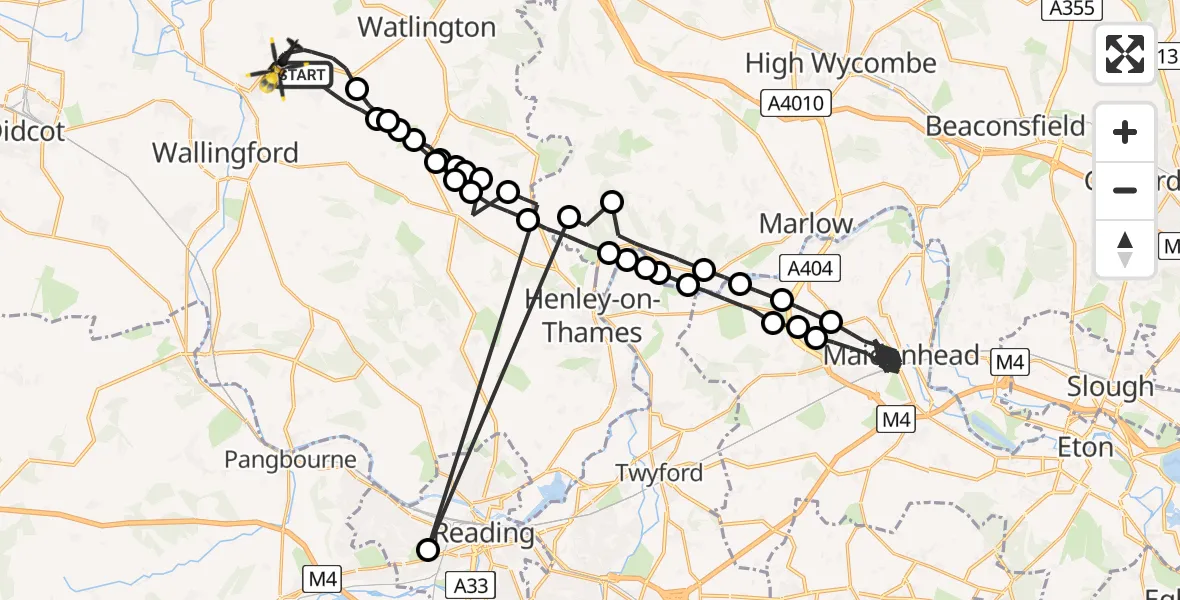
On Sunday, 18 January 2026 at 18:30, a Police Helicopter departed from Ewelme to Benson. It was the Police Helicopter with registration number G-POLD. The flight lasted 31 minutes. During that period, the aircraft travelled 68 miles at an average speed of 133 miles per hour at a maximum altitude of 1400 feet.
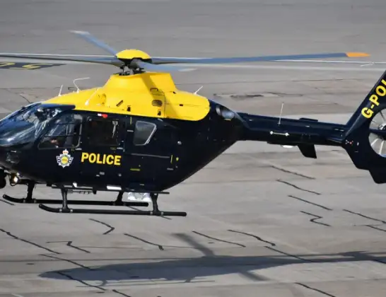
Helicopter: G-POLD
The helicopter G-POLD is used by the British police. The helicopter is deployed in pursuits, missing persons cases and other incidents where a helicopter provides added value.
Photo: Alec Wilson
69 miles
1400 feet
133 mph
31 minutes
18:30
19:01

Route
The Sands, South Oxfordshire19:01
Ewelme, South Oxfordshire18:59
Cookley Green, South Oxfordshire18:59
South Oxfordshire18:59
Park Corner, South Oxfordshire18:58
South Oxfordshire18:58
Nettlebed, South Oxfordshire18:58
South Oxfordshire18:57
Fawley18:56
Hambleden18:56
Aston18:55
Hambleden18:55
Medmenham18:55
Hurley18:54
Bisham18:53
Pinkneys Green18:53
Maidenhead18:38
Bisham18:38
Hurley18:37
Medmenham18:37
Hambleden18:35
Fawley18:35
Reading18:34
South Oxfordshire18:34
Nettlebed, South Oxfordshire18:33
South Oxfordshire18:33
Cookley Green, South Oxfordshire18:33
Park Corner, South Oxfordshire18:32
Cookley Green, South Oxfordshire18:32
South Oxfordshire18:31
Ewelme, South Oxfordshire18:30
Today
Police Helicopter to Epping Forest, Green Lane26 Feb 23:43
Flights Benson
Police Helicopter to Ewelme, Ewelme26 Feb 19:25
Police Helicopter to Benson, The Sands25 Feb 22:31
Police Helicopter to Ewelme, Ewelme25 Feb 19:01
Police Helicopter to Benson, Benson19 Feb 19:43
Police Helicopter to Benson, Clack's Lane19 Feb 15:39
Police Helicopter to Benson, Clack's Lane18 Feb 17:38
Police Helicopter to Benson, The Sands16 Feb 19:51
Police Helicopter to Ewelme, The Sands15 Feb 20:41
Police Helicopter to Benson, Brook Street14 Feb 22:52
Flights Ewelme
Police Helicopter to Ewelme, Ewelme26 Feb 19:25
Police Helicopter to Ewelme, The Sands25 Feb 20:47
Police Helicopter to Ewelme, Ewelme25 Feb 19:01
Police Helicopter to Ewelme, Eyre's Lane25 Feb 16:31
Police Helicopter to Ewelme, Ewelme24 Feb 19:10
Police Helicopter to Ewelme, Hollandtide Lane24 Feb 15:00
Police Helicopter to Benson, Clack's Lane18 Feb 17:38
Helicopter flights on your website?
You can easily display helicopter flights on your own website. Use the embed code.
