Air Ambulance Helicopter to Coventry, Arch Road
Saturday, 17 January 2026 | 13:42 | From Market Bosworth
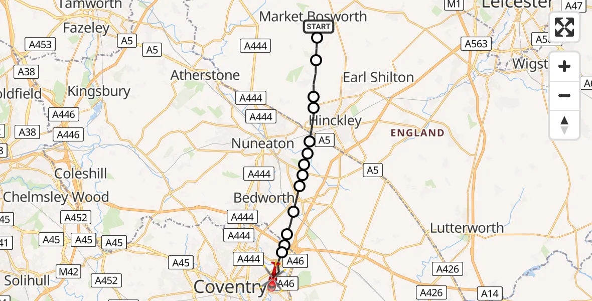
On Saturday, 17 January 2026 at 13:42, a Air Ambulance Helicopter departed from Market Bosworth to Coventry. It was the Air Ambulance Helicopter with registration number G-WNAS. The flight lasted 6 minutes. During that period, the aircraft travelled 14 miles at an average speed of 145 miles per hour at a maximum altitude of 1125 feet.
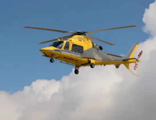
Helicopter: G-WNAS
The helicopter G-WNAS is used as an ambulance helicopter. The helicopter is equipped with a stretcher for transporting patients. The helicopter is often used to transport to hospitals.
Photo: Tony Melony
15 miles
1125 feet
145 mph
6 minutes
13:42
13:48

Route
Arch Road, West Midlands13:48
Coventry, West Midlands13:47
Ansty CP, Rugby13:47
Rugby, West Midlands13:47
Barnacle, Rugby13:46
Bulkington, Nuneaton and Bedworth13:46
Nuneaton and Bedworth13:46
Bedworth, Nuneaton and Bedworth13:45
Nuneaton, Nuneaton and Bedworth13:45
Moxon's Farm Private Airstrip13:45
Hinckley, Hinckley and Bosworth13:44
Stoke Golding, Hinckley and Bosworth13:44
Dadlington, Hinckley and Bosworth13:43
Sutton Cheney, Hinckley and Bosworth13:43
Cedar Drive, Hinckley and Bosworth13:42
Live flights
Today
Flights Coventry
Police Helicopter to Birmingham Airport30 Mar 18:47
Police Helicopter to Coventry, Moat Avenue30 Mar 18:32
Air Ambulance Helicopter to Coventry Airport28 Mar 18:31
Helicopter flights on your website?
You can easily display helicopter flights on your own website. Use the embed code.
