Police Helicopter to South Nutfield, Mill Brook Mews
Saturday, 17 January 2026 | 13:18 | From Staplefield
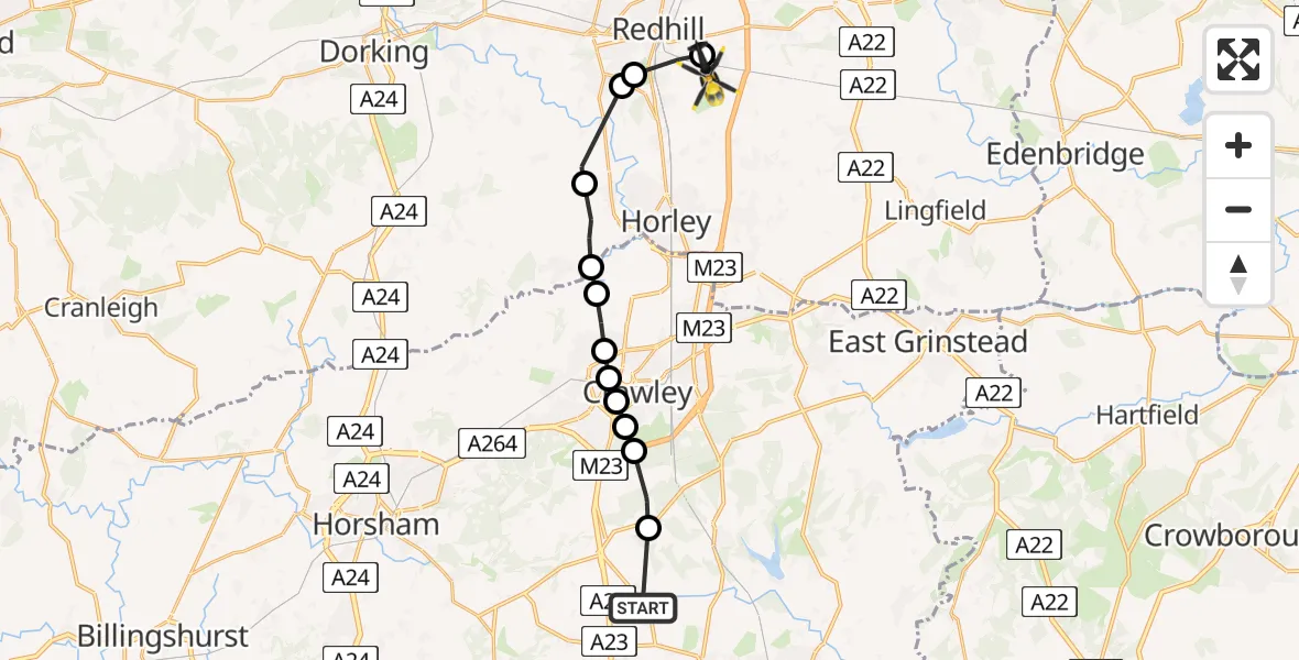
On Saturday, 17 January 2026 at 13:18, a Police Helicopter departed from Staplefield to South Nutfield. It was the Police Helicopter with registration number G-POLH. The flight lasted 6 minutes. During that period, the aircraft travelled 16 miles at an average speed of 152 miles per hour at a maximum altitude of 1400 feet.
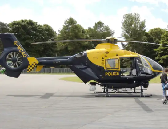
Helicopter: G-POLH
The helicopter G-POLH is used by the British police. The helicopter is deployed in pursuits, missing persons cases and other incidents where a helicopter provides added value.
Photo: Arpingstone
17 miles
1400 feet
152 mph
7 minutes
13:18
13:25

Route
Mill Brook Mews, 13:25
South Nutfield13:24
Redhill, Reigate and Banstead13:24
Reigate, Reigate and Banstead13:23
Norwood Hill, Reigate and Banstead13:22
Charlwood, Mole Valley13:22
London Gatwick Airport, London13:21
Langley Green, Crawley13:21
West Green, Crawley13:21
Southgate, Crawley13:20
Tilgate, Crawley13:20
Maidenbower, Crawley13:20
Slaugham, Mid Sussex13:19
Cuckfield Road, Mid Sussex13:18
Today
Flights Staplefield
Helicopter flights on your website?
You can easily display helicopter flights on your own website. Use the embed code.
