Police Helicopter to Benson, The Sands
Friday, 16 January 2026 | 16:35 | From South Oxfordshire
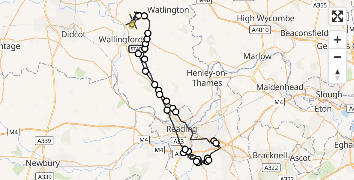
On Friday, 16 January 2026 at 16:35, a Police Helicopter departed from South Oxfordshire to Benson. It was the Police Helicopter with registration number G-POLD. The flight lasted 32 minutes. During that period, the aircraft travelled 51 miles at an average speed of 94 miles per hour at a maximum altitude of 1600 feet.

Helicopter: G-POLD
The helicopter G-POLD is used by the British police. The helicopter is deployed in pursuits, missing persons cases and other incidents where a helicopter provides added value.
Photo: Alec Wilson
51 miles
1600 feet
94 mph
33 minutes
16:35
17:08

Route
The Sands, South Oxfordshire17:08
Ewelme, South Oxfordshire17:07
Cuxham, South Oxfordshire17:07
Ewelme, South Oxfordshire17:06
Benson, South Oxfordshire17:05
Nuffield, South Oxfordshire17:05
South Oxfordshire17:05
Ipsden, South Oxfordshire17:04
Checkendon, South Oxfordshire17:03
Gallowstree Common, South Oxfordshire17:03
Mapledurham, South Oxfordshire17:02
Reading16:59
Shinfield16:58
Reading16:57
Shinfield16:53
Arborfield16:50
Sindlesham16:50
Arborfield16:49
Shinfield16:48
Arborfield16:47
Sindlesham16:43
Winnersh16:42
Reading16:40
South Oxfordshire16:39
Mapledurham, South Oxfordshire16:39
Gallowstree Common, South Oxfordshire16:38
Checkendon, South Oxfordshire16:37
Ipsden, South Oxfordshire16:36
Grim's Ditch, 16:35
Live flights
Today
Police Helicopter to Epping Forest, Green Lane26 Feb 23:43
Flights Benson
Police Helicopter to Ewelme, Ewelme26 Feb 19:25
Police Helicopter to Benson, The Sands25 Feb 22:31
Police Helicopter to Ewelme, Ewelme25 Feb 19:01
Police Helicopter to Benson, Benson19 Feb 19:43
Police Helicopter to Benson, Clack's Lane19 Feb 15:39
Police Helicopter to Benson, Clack's Lane18 Feb 17:38
Police Helicopter to Benson, The Sands16 Feb 19:51
Police Helicopter to Ewelme, The Sands15 Feb 20:41
Police Helicopter to Benson, Brook Street14 Feb 22:52
Helicopter flights on your website?
You can easily display helicopter flights on your own website. Use the embed code.
