Air Ambulance Helicopter to Kirkbride, B5307
Friday, 16 January 2026 | 13:11 | From Gaitsgill
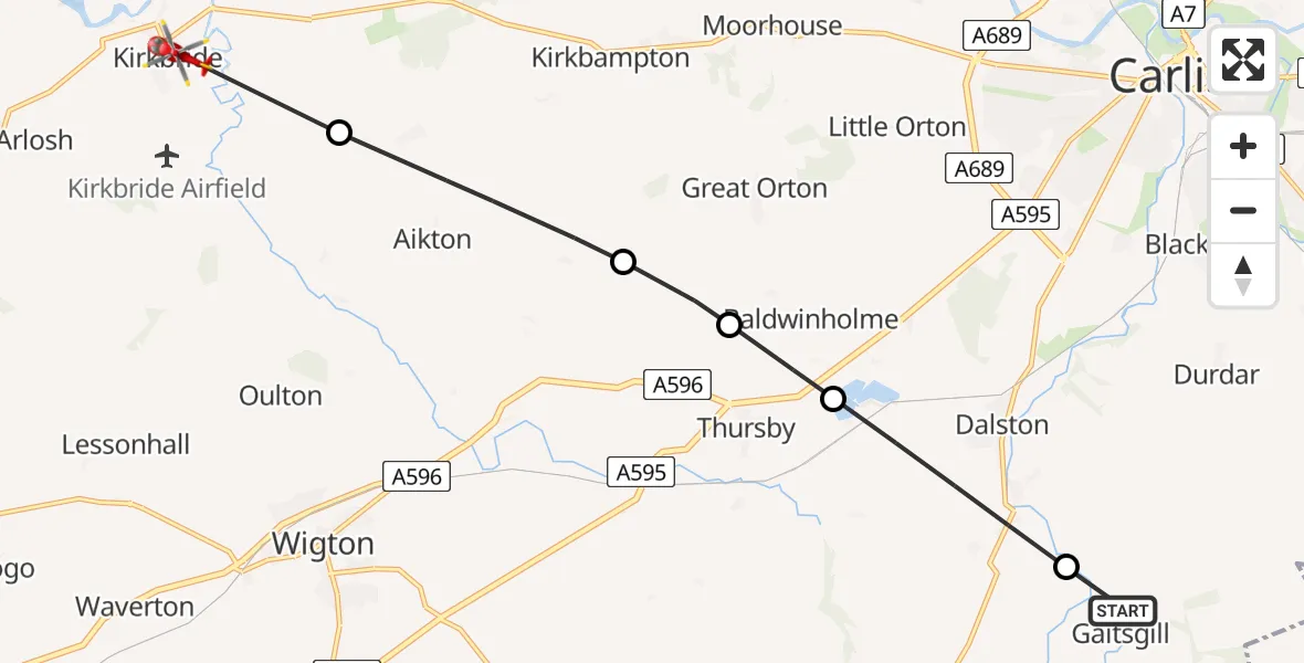
On Friday, 16 January 2026 at 13:11, a Air Ambulance Helicopter departed from Gaitsgill to Kirkbride. It was the Air Ambulance Helicopter with registration number G-NHAE. The flight lasted 4 minutes. During that period, the aircraft travelled 11 miles at an average speed of 169 miles per hour at a maximum altitude of 2025 feet.
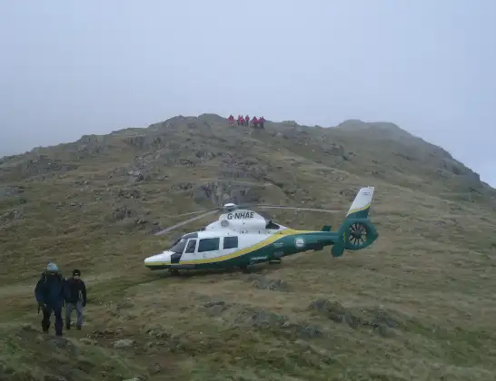
Helicopter: G-NHAE
The helicopter G-NHAE is used as a air ambulance helicopter. The main purpose of this aircraft is to transport a Mobile Medical Team to an incident as quickly as possible, enabling the trauma doctor to provide immediate first aid on site. The aircraft is flying this flight as Air Ambulance Helicopter.
Photo: Michael Earnshaw
12 miles
2025 feet
169 mph
5 minutes
13:11
13:15

Route
B5307, 13:15
Kirkbampton13:14
Aikton13:13
Great Orton13:13
Baldwinholme13:12
Dalston13:11
Gaitsgill, 13:11
Live flights
Today
Police Helicopter to MOD St Athan15 Jul 23:53
Police Helicopter to East Ardsley, Stoney Lane15 Jul 23:36
Flights Kirkbride
Air Ambulance Helicopter to Kirkbride, B530716 Jan 13:11
Flights Gaitsgill
Air Ambulance Helicopter to Kirkbride, B530716 Jan 13:11
Helicopter flights on your website?
You can easily display helicopter flights on your own website. Use the embed code.
