Coastguard Helicopter to Kintradwell, Inver
Thursday, 15 January 2026 | 15:15 | From Inver
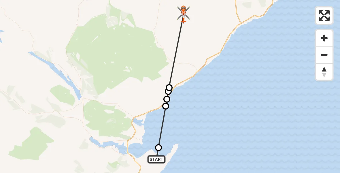
On Thursday, 15 January 2026 at 15:15, a Coastguard Helicopter departed from Inver to Kintradwell. It was the Coastguard Helicopter with registration number G-MCGT. The flight lasted 13 minutes. During that period, the aircraft travelled 35 miles at an average speed of 167 miles per hour at a maximum altitude of 3075 feet.
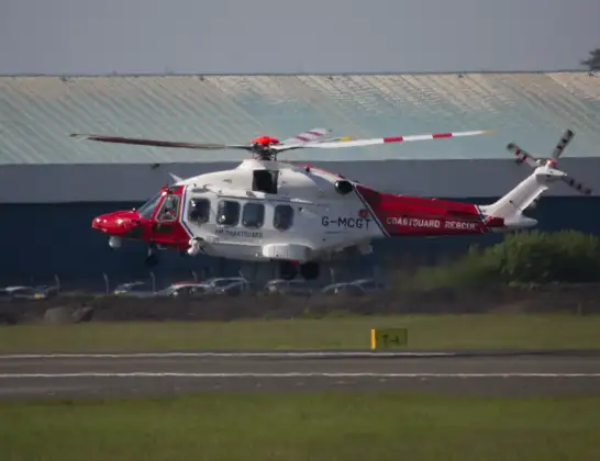
Helicopter: G-MCGT
The helicopter G-MCGT is used by the British Coastguard. The helicopter is deployed in search and rescue operations at sea, rescue operations involving ships or drilling platforms, patrols to prevent smuggling or piracy, environmental monitoring and disaster relief support.
Photo: Ronnie Macdonald
36 miles
3075 feet
167 mph
13 minutes
15:15
15:27

Route
15:27
Kintradwell15:21
Clynemilton15:20
Glashbuie15:20
Brora15:19
North Sea15:16
Inver, 15:15
Today
Flights Kintradwell
Coastguard Helicopter to Kintradwell, Inver15 Jan 15:15
Flights Inver
Coastguard Helicopter to Inverness Airport14 Feb 15:19
Air Ambulance Helicopter to Inver29 Jan 12:45
Coastguard Helicopter to Kintradwell, Inver15 Jan 15:15
Helicopter flights on your website?
You can easily display helicopter flights on your own website. Use the embed code.
