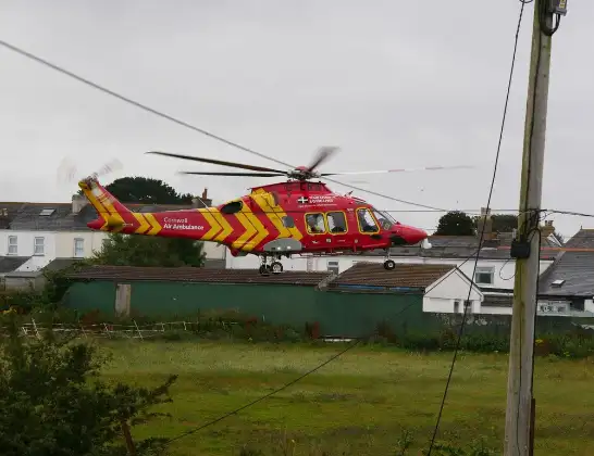
Air Ambulance Helicopter to Cornwall Airport Newquay
Thursday, 15 January 2026 | 13:53 | From Polperro
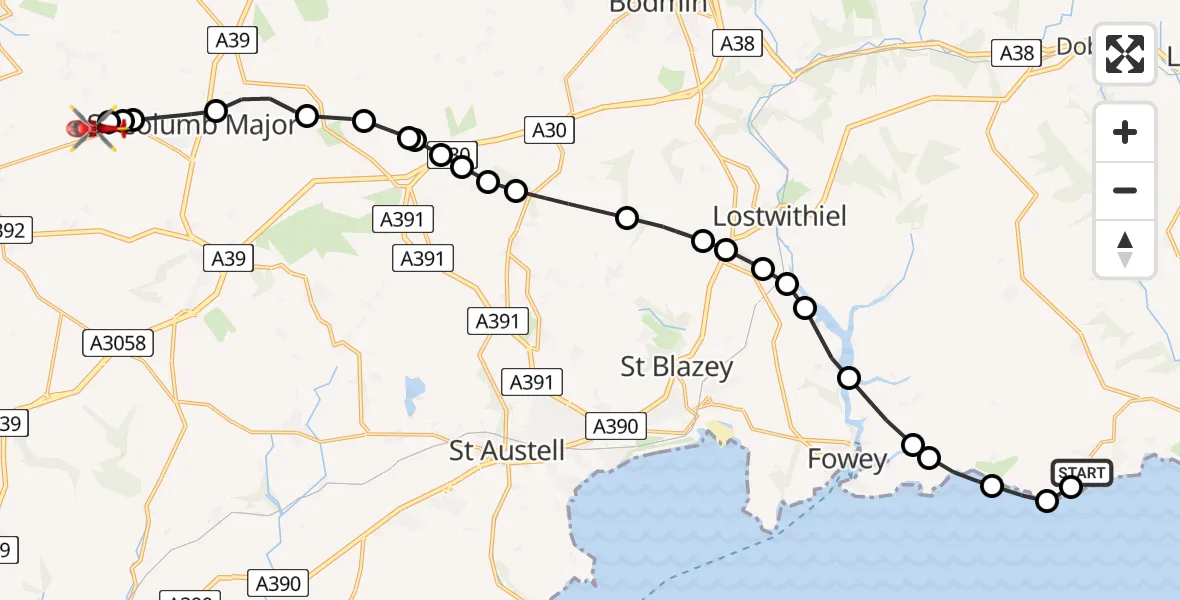
On Thursday, 15 January 2026 at 13:53, a Air Ambulance Helicopter departed from Polperro to Cornwall Airport Newquay. It was the Air Ambulance Helicopter with registration number G-CRWL. The flight lasted 11 minutes. During that period, the aircraft travelled 23 miles at an average speed of 123 miles per hour at a maximum altitude of 1525 feet.
Helicopter: G-CRWL
The helicopter G-CRWL is used as a air ambulance helicopter. The main purpose of this aircraft is to transport a Mobile Medical Team to an incident as quickly as possible, enabling the trauma doctor to provide immediate first aid on site. The aircraft is flying this flight as Air Ambulance Helicopter.
Photo: Pete Cruse
24 miles
1525 feet
123 mph
12 minutes
13:53
14:05

Route
Cornwall Airport Newquay, Newquay14:05
Cornwall Airport Newquay, Newquay14:04
St. Columb Major14:04
St. Mawgan14:03
Gluvian, St. Columb Major14:03
Tremayne, St. Columb Major14:02
St. Wenn14:01
Roche14:01
Withiel14:01
Roche14:00
Luxulyan14:00
Roche Barton Farm Airstrip, Saint Austell, Cornwall14:00
Bugle14:00
Luxulyan13:59
Lanlivery13:58
Lostwithiel13:58
Lanlivery13:57
Golant13:57
Lostwithiel13:57
Golant13:56
Lanteglos13:55
Polruan13:55
Lansallos13:54
Polperro13:54
Lansallos13:53
Raphael Road, 13:53
Live flights
Today
Flights Polperro
Police Helicopter to St. Columb Major, A30592 Jul 17:03
Coastguard Helicopter to Lansallos, Polperro7 Apr 10:46
Helicopter flights on your website?
You can easily display helicopter flights on your own website. Use the embed code.
