Air Ambulance Helicopter to Hemsby, Stable Field Way
Thursday, 15 January 2026 | 12:59 | From Norwich Airport
On Thursday, 15 January 2026 at 12:59, a Air Ambulance Helicopter departed from Norwich Airport to Hemsby. It was the Air Ambulance Helicopter with registration number G-HEMC. The flight lasted 14 minutes. During that period, the aircraft travelled 22 miles at an average speed of 93 miles per hour at a maximum altitude of 1025 feet.
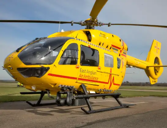
Helicopter: G-HEMC
The helicopter G-HEMC is used as a air ambulance helicopter. The main purpose of this aircraft is to transport a Mobile Medical Team to an incident as quickly as possible, enabling the trauma doctor to provide immediate first aid on site. The aircraft is flying this flight as Air Ambulance Helicopter.
Photo: Jsmauger
23 miles
1025 feet
93 mph
15 minutes
12:59
13:13

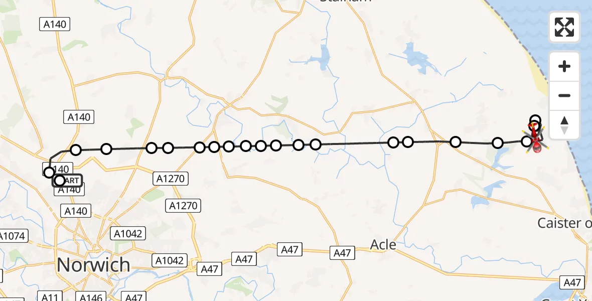
Route
Stable Field Way, Great Yarmouth13:13
Hemsby, Great Yarmouth13:12
Winterton-on-Sea, Great Yarmouth13:11
Hemsby, Great Yarmouth13:09
Great Yarmouth13:09
Rollesby, Great Yarmouth13:08
Bastwick, Great Yarmouth13:07
Thurne, Great Yarmouth13:07
North Norfolk13:06
Horning, North Norfolk13:05
Woodbastwick, Broadland13:05
Broadland13:05
Hoveton, North Norfolk13:05
Salhouse, Broadland13:04
Broadland13:04
Rackheath, Broadland13:04
Wroxham, Broadland13:03
Crostwick, Broadland13:03
Spixworth, Broadland13:02
Horsham St Faith, Broadland13:02
Horsford, Broadland13:01
Broadland13:01
Norwich Airport, Norwich, Norfolk12:59
Norwich Airport, Norwich, Norfolk12:59
Live flights
Police Helicopter on its way from MOD St Athan15 Jul 23:53
Police Helicopter on its way from Wrenthorpe15 Jul 23:36
Today
Police Helicopter to Glasgow, Renfrew Road15 Jul 23:45
Police Helicopter to Manchester Barton Aerodrome15 Jul 23:33
Police Helicopter to Renfrewshire15 Jul 23:32
Air Ambulance Helicopter to Southampton Airport15 Jul 23:30
Police Helicopter to Coopersale, Epping Road15 Jul 23:07
Police Helicopter to Largs, Lane 115 Jul 23:02
Flights Hemsby
Air Ambulance Helicopter to Norwich Airport15 Jan 14:00
Helicopter flights on your website?
You can easily display helicopter flights on your own website. Use the embed code.
