Police Helicopter to Sewardstonebury, Lippitts Hill
Wednesday, 14 January 2026 | 16:58 | From Denham
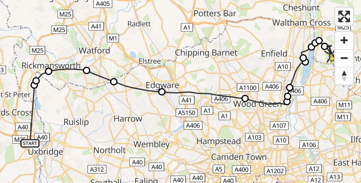
On Wednesday, 14 January 2026 at 16:58, a Police Helicopter departed from Denham to Sewardstonebury. It was the Police Helicopter with registration number G-MPSC. The flight lasted 15 minutes. During that period, the aircraft travelled 32 miles at an average speed of 129 miles per hour at a maximum altitude of 1600 feet.
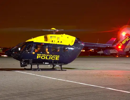
Helicopter: G-MPSC
The helicopter G-MPSC is used by the British police. The helicopter is deployed in pursuits, missing persons cases and other incidents where a helicopter provides added value.
Photo: aceebee, Camberley, UK
32 miles
1600 feet
129 mph
15 minutes
16:58
17:13

Route
Lippitts Hill, Epping Forest17:13
Sewardstonebury, Epping Forest17:12
Epping Forest, Essex17:12
London Borough of Enfield, Epping Forest17:12
King George V Reservoir17:12
London Borough of Enfield, Greater London17:11
King George V Reservoir17:11
London Borough of Enfield, Greater London17:09
London Borough of Haringey, Greater London17:09
Tottenham, Greater London17:09
London Borough of Haringey, Greater London17:07
London Borough of Barnet, Greater London17:03
London Borough of Harrow, Greater London17:02
South Oxhey, Three Rivers17:01
Rickmansworth, Three Rivers16:59
London Borough of Hillingdon, Greater London16:59
Maple Cross, Three Rivers16:59
Willetts Lane, 16:58
Live flights
Today
Flights Sewardstonebury
Police Helicopter to Sewardstonebury, Bury Road12 Jul 15:15
Police Helicopter to Sewardstonebury, Bury Road12 Jul 13:50
Police Helicopter to Sewardstonebury, Bury Road11 Jul 17:40
Police Helicopter to London Biggin Hill Airport11 Jul 13:12
Flights Denham
Air Ambulance Helicopter to Denham, M2523 Jun 13:27
Air Ambulance Helicopter to Denham, Oxford Road22 Apr 10:17
Police Helicopter to Denham, North Orbital Road23 Feb 10:10
Helicopter flights on your website?
You can easily display helicopter flights on your own website. Use the embed code.
