Police Helicopter to Cranleigh, East Whipley Lane
Wednesday, 14 January 2026 | 12:42 | From Horley
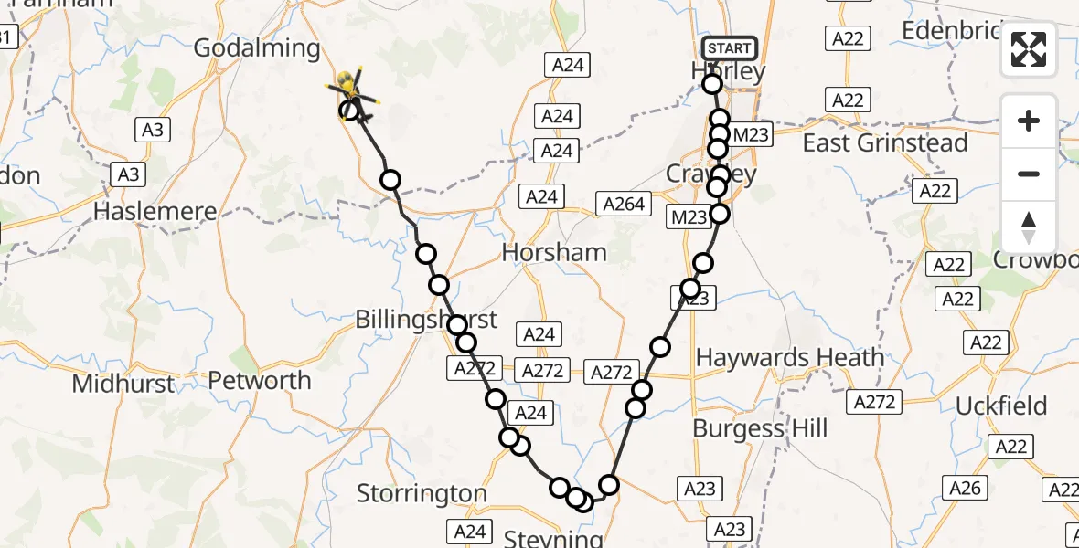
On Wednesday, 14 January 2026 at 12:42, a Police Helicopter departed from Horley to Cranleigh. It was the Police Helicopter with registration number G-POLH. The flight lasted 18 minutes. During that period, the aircraft travelled 41 miles at an average speed of 141 miles per hour at a maximum altitude of 1400 feet.
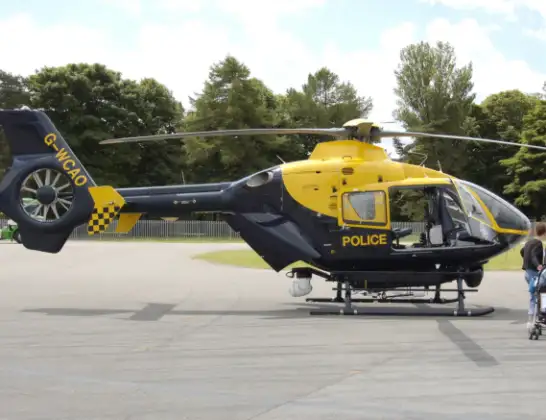
Helicopter: G-POLH
The helicopter G-POLH is used by the British police. The helicopter is deployed in pursuits, missing persons cases and other incidents where a helicopter provides added value.
Photo: Arpingstone
42 miles
1400 feet
141 mph
18 minutes
12:42
12:59

Route
East Whipley Lane, Waverley12:59
Rydinghurst Farm Airstrip, Guildford, Surrey12:59
Cranleigh, Waverley12:58
Rudgwick, Horsham12:57
Five Oaks, Horsham12:56
Billingshurst12:56
Coolham, Horsham12:55
Shipley, Horsham12:54
West Grinstead, Horsham12:54
Shipley, Horsham12:53
Ashurst, Horsham12:52
Ashurst, Steyning12:52
Steyning12:52
Henfield, Horsham12:51
Horsham12:50
Cowfold, Horsham12:49
Bolney, Mid Sussex12:48
Slaugham, Mid Sussex12:47
Handcross, Mid Sussex12:47
Slaugham, Mid Sussex12:46
Tilgate, Crawley12:45
Furnace Green, Crawley12:45
Three Bridges, Crawley12:45
Manor Royal, Crawley12:44
Tinsley Green, Crawley12:44
London Gatwick Airport, London12:43
Skipton Way, Reigate and Banstead12:42
Today
Police Helicopter to Epping Forest, Green Lane26 Feb 23:43
Flights Cranleigh
to Cranleigh, Cooks Hill25 Jan 11:57
Flights Horley
Helicopter flights on your website?
You can easily display helicopter flights on your own website. Use the embed code.
