Police Helicopter to Twyford, Hazeley Road
Wednesday, 14 January 2026 | 12:16 | From Solent Airport
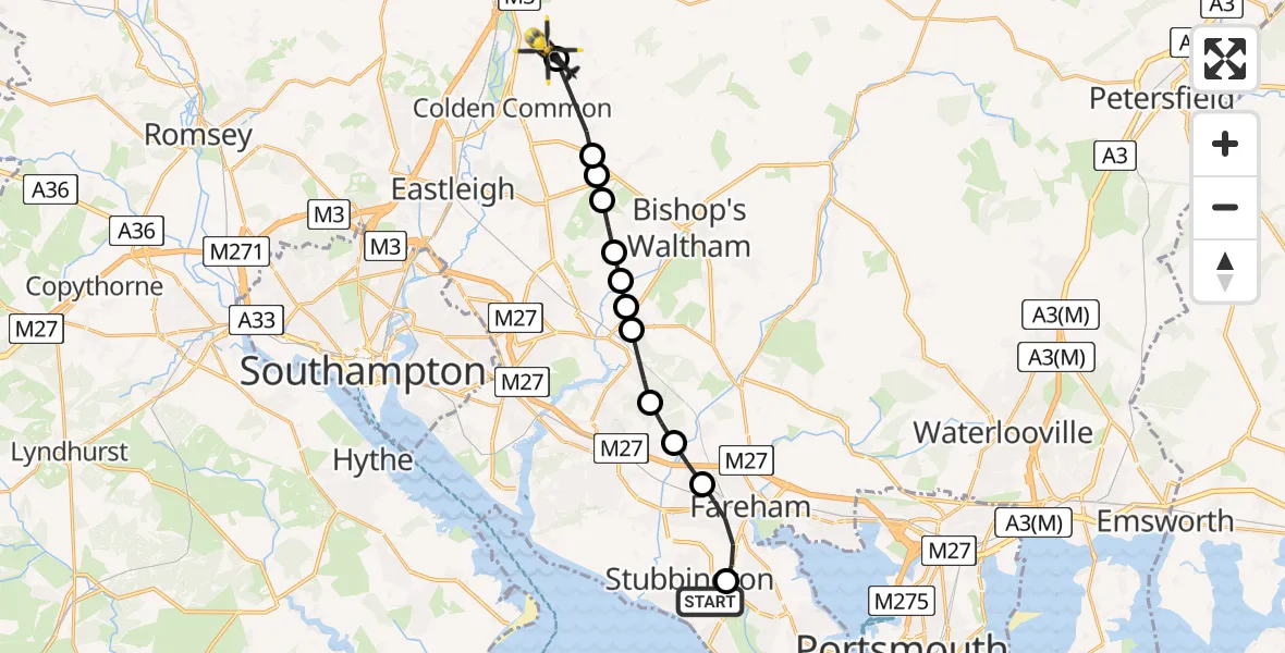
On Wednesday, 14 January 2026 at 12:16, a Police Helicopter departed from Solent Airport to Twyford. It was the Police Helicopter with registration number G-BZRS. The flight lasted 6 minutes. During that period, the aircraft travelled 15 miles at an average speed of 143 miles per hour at a maximum altitude of 1525 feet.
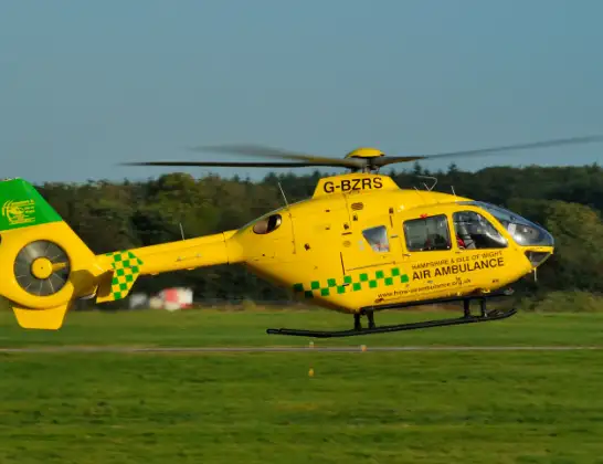
Helicopter: G-BZRS
The helicopter G-BZRS is used by the British police. The helicopter is deployed in pursuits, missing persons cases and other incidents where a helicopter provides added value.
Photo: NMOS332
15 miles
1525 feet
143 mph
7 minutes
12:16
12:22

Route
Hazeley Road, Winchester12:22
Winchester12:22
Lower Upham, Winchester12:21
Eastleigh12:21
Lower Upham, Winchester12:21
Durley, Winchester12:20
Curdridge, Winchester12:20
Curdridge, Southampton12:19
Curdridge, Winchester12:19
Curbridge, Winchester12:19
Knowle, Winchester12:18
Funtley, Fareham12:17
Fareham12:16
Solent Airport, Gosport, Hampshire12:16
Live flights
Today
Flights Twyford
Air Ambulance Helicopter to Thruxton Aerodrome20 Feb 15:36
Police Helicopter to Twyford, Hazeley Road14 Jan 12:16
Helicopter flights on your website?
You can easily display helicopter flights on your own website. Use the embed code.
