Air Ambulance Helicopter to Brackley, St. Peter's Road
Tuesday, 13 January 2026 | 12:42 | From Coventry Airport
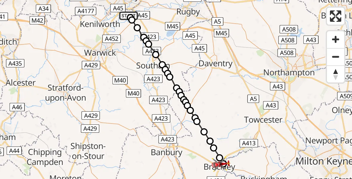
On Tuesday, 13 January 2026 at 12:42, a Air Ambulance Helicopter departed from Coventry Airport to Brackley. It was the Air Ambulance Helicopter with registration number G-WNAS. The flight lasted 11 minutes. During that period, the aircraft travelled 28 miles at an average speed of 149 miles per hour at a maximum altitude of 1775 feet.
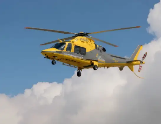
Helicopter: G-WNAS
The helicopter G-WNAS is used as an ambulance helicopter. The helicopter is equipped with a stretcher for transporting patients. The helicopter is often used to transport to hospitals.
Photo: Tony Melony
28 miles
1775 feet
149 mph
12 minutes
12:42
12:53

Route
St. Peter's Road, 12:53
Whitfield12:53
Brackley12:52
Radstone12:51
Helmdon12:51
Sulgrave12:50
Culworth12:50
Eydon12:49
Chipping Warden and Edgcote12:49
Aston le Walls12:49
Daventry12:48
Upper Boddington12:48
Boddington12:48
Stratford-on-Avon12:48
Priors Marston, Stratford-on-Avon12:47
Stratford-on-Avon12:47
Napton on the Hill, Stratford-on-Avon12:46
Stratford-on-Avon12:46
Napton on the Hill, Stratford-on-Avon12:46
Stockton CP, Stratford-on-Avon12:45
Long Itchington, Stratford-on-Avon12:44
Marton CP, Rugby12:44
Eathorpe, Warwick12:44
Wappenbury, Warwick12:43
Bubbenhall, Warwick12:42
Baginton, Warwick12:42
Siskin Parkway West, Warwick12:42
Live flights
Today
Flights Brackley
Air Ambulance Helicopter to Coventry Airport21 May 12:30
Helicopter flights on your website?
You can easily display helicopter flights on your own website. Use the embed code.
