Police Helicopter to MOD St Athan
Tuesday, 13 January 2026 | 2:37 | From Muddiford
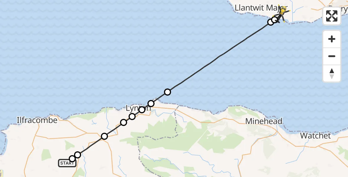
On Tuesday, 13 January 2026 at 2:37, a Police Helicopter departed from Muddiford to MOD St Athan. It was the Police Helicopter with registration number G-NWOI. The flight lasted 12 minutes. During that period, the aircraft travelled 32 miles at an average speed of 164 miles per hour at a maximum altitude of 2975 feet.
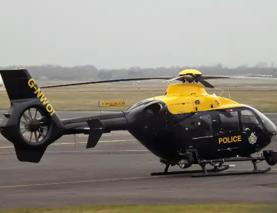
Helicopter: G-NWOI
The helicopter G-NWOI is used by the British police. The helicopter is deployed in pursuits, missing persons cases and other incidents where a helicopter provides added value.
Photo: James from Cheltenham
33 miles
2975 feet
164 mph
12 minutes
02:37
02:49

Route
MOD St Athan, St Athan, Vale of Glamorgan02:49
Llantwit Major02:48
Boverton02:48
Bristol Channel02:42
North Devon, Devon and Torbay02:41
Lynmouth, North Devon02:41
Barbrook, North Devon02:40
North Devon, Devon and Torbay02:40
Parracombe, North Devon02:39
North Devon, Devon and Torbay02:37
Shirwell, North Devon02:37
Rookbear Lane, North Devon02:37
Live flights
Air Ambulance Helicopter on its way from Ashford14 Jul 23:46
Coastguard Helicopter on its way from North Sea14 Jul 23:44
Police Helicopter on its way from Inner Seas14 Jul 23:38
Today
Coastguard Helicopter to North Sea14 Jul 23:30
Police Helicopter to Inner Seas14 Jul 23:12
Air Ambulance Helicopter to Norwich Airport14 Jul 22:52
Police Helicopter to Manchester Barton Aerodrome14 Jul 22:50
Police Helicopter to Sewardstonebury, Bury Road14 Jul 22:44
Air Ambulance Helicopter to Cardiff Heliport14 Jul 22:43
Coastguard Helicopter to North Sea14 Jul 22:40
Flights Muddiford
Air Ambulance Helicopter to Crowcombe, A35829 May 10:16
Police Helicopter to MOD St Athan13 Jan 02:37
Helicopter flights on your website?
You can easily display helicopter flights on your own website. Use the embed code.
