Air Ambulance Helicopter to Stamford, Sandringham Close
Monday, 12 January 2026 | 15:58 | From Rushcliffe
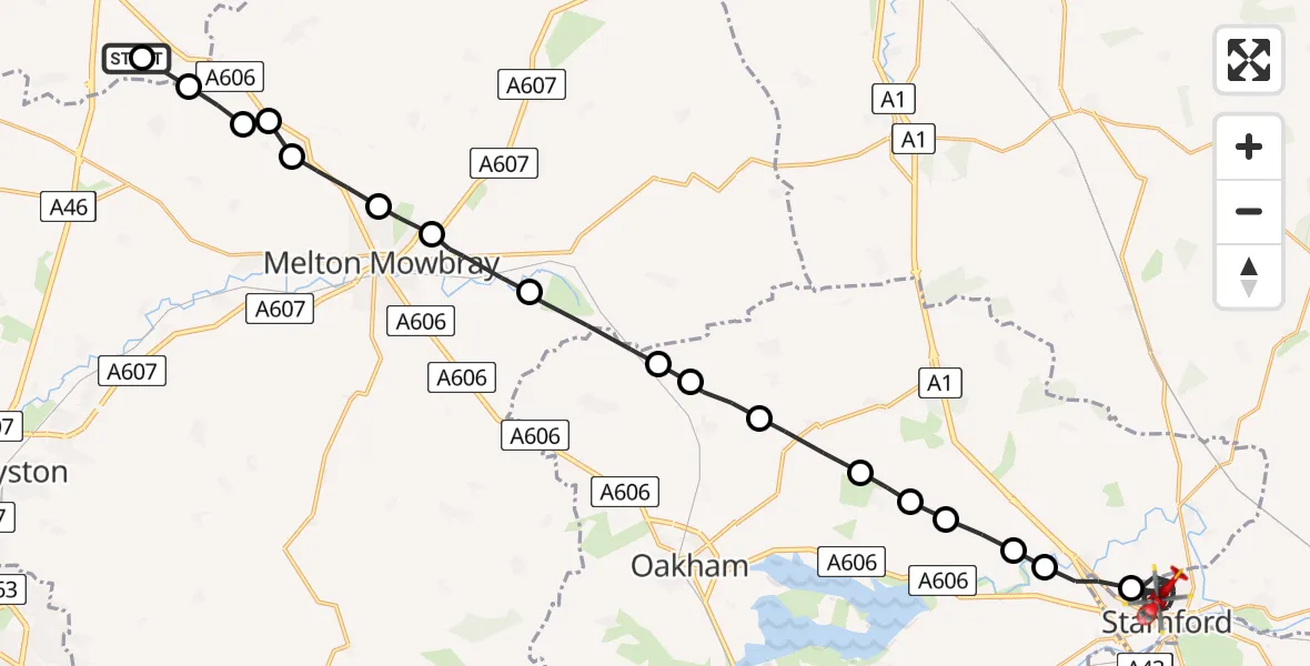
On Monday, 12 January 2026 at 15:58, a Air Ambulance Helicopter departed from Rushcliffe to Stamford. It was the Air Ambulance Helicopter with registration number G-DRLA. The flight lasted 19 minutes. During that period, the aircraft travelled 33 miles at an average speed of 107 miles per hour at a maximum altitude of 1550 feet.
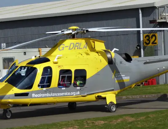
Helicopter: G-DRLA
The helicopter G-DRLA is used as an ambulance helicopter. The helicopter is equipped with a stretcher for transporting patients. The helicopter is often used to transport to hospitals.
Photo: Alec Wilson
34 miles
1550 feet
107 mph
19 minutes
15:58
16:16

Route
Sandringham Close, South Kesteven16:16
Stamford, South Kesteven16:06
Toll Bar16:06
Tickencote16:05
Empingham16:05
Exton and Horn16:05
Exton16:04
Cottesmore16:03
Ashwell16:03
Whissendine16:02
Melton16:01
Thorpe Arnold, Melton16:00
Melton Mowbray, Melton16:00
Ab Kettleby, Melton15:59
Wartnaby, Melton15:59
Ab Kettleby, Melton15:59
Queensway Old Dalby, Melton15:58
Upper Broughton, Rushcliffe15:58
Station Road, East Midlands15:58
Live flights
Today
Flights Stamford
Flights Rushcliffe
Air Ambulance Helicopter to Rushcliffe, A461 Jul 18:42
Air Ambulance Helicopter to Ashwell, Oakham30 Jun 12:44
Air Ambulance Helicopter to Rushcliffe, A4629 Jun 11:54
Air Ambulance Helicopter to East Carlton, A42727 Jun 11:00
Helicopter flights on your website?
You can easily display helicopter flights on your own website. Use the embed code.
