Air Ambulance Aircraft to Inner Seas
Monday, 12 January 2026 | 13:54 | From Glasgow Airport
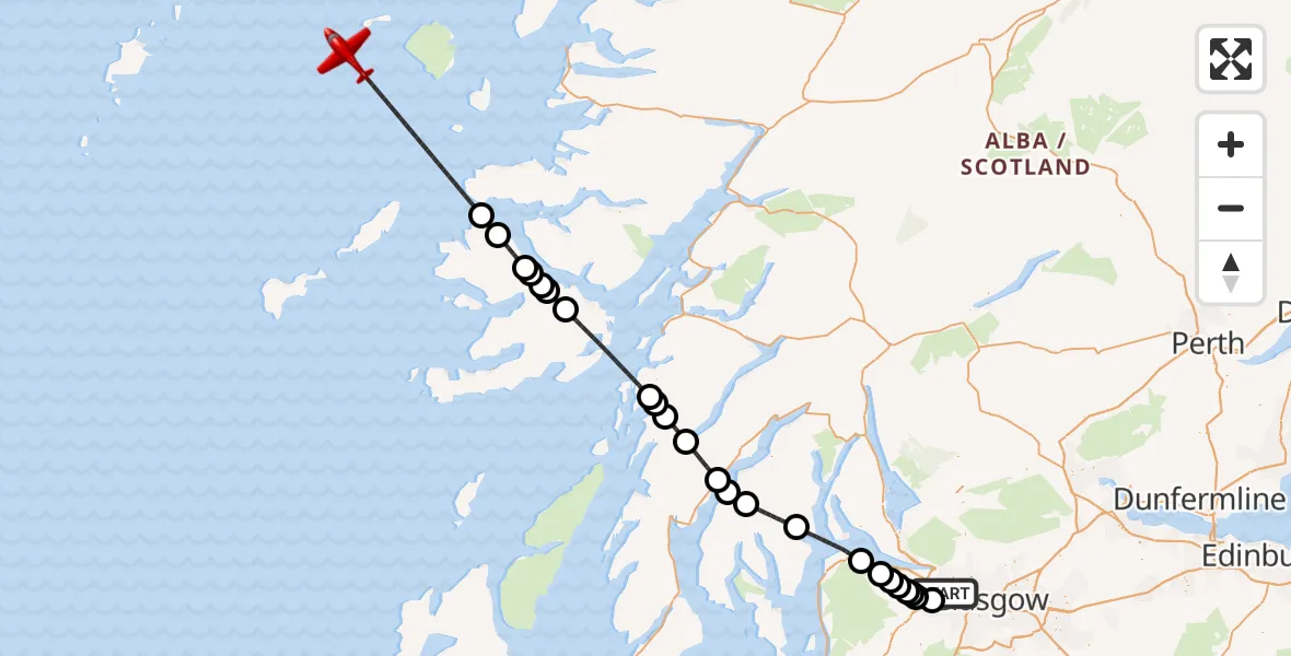
On Monday, 12 January 2026 at 13:54, a Air Ambulance Aircraft departed from Glasgow Airport to Inner Seas. It was the Air Ambulance Aircraft with registration number G-SASC. The flight lasted 32 minutes. During that period, the aircraft travelled 119 miles at an average speed of 222 miles per hour at a maximum altitude of 16025 feet.
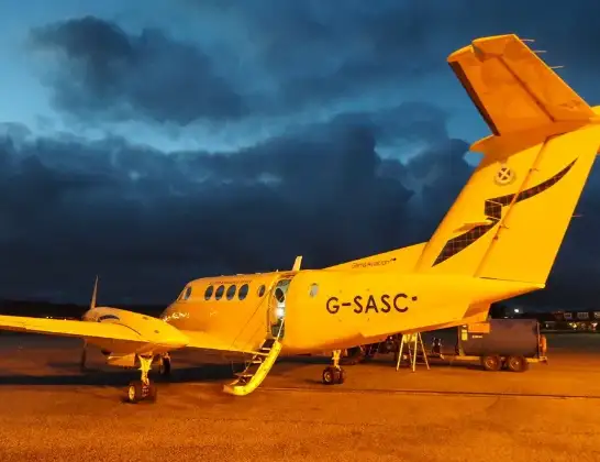
Helicopter: G-SASC
The aircraft G-SASC is used as an air ambulance aircraft. The main purpose of this aircraft is to transport a Mobile Medical Team to an incident as quickly as possible, enabling the trauma doctor to provide immediate first aid on site. The aircraft is flying this flight as Air Ambulance Aircraft.
Photo: Mike Pennington
119 miles
16025 feet
222 mph
33 minutes
13:54
14:26

Route
Inner Seas, 14:26
Inner Seas14:20
Sorne14:19
Kentallen14:18
Aros Bridge14:18
Salen14:17
Pennygown14:17
Rhoail14:16
Inner Seas14:13
Arduaine14:12
Kilmelford14:12
Loch Awe14:11
Minard14:09
Inner Seas14:09
Clachan of Glendaruel14:08
Sandhaven14:06
Inner Seas14:03
Port Glasgow14:02
Kilmacolm14:01
Bishopton14:01
Houston14:00
Johnstone14:00
Crosslee14:00
Linwood13:59
Glasgow Airport, Glasgow13:58
Glasgow Airport, Glasgow13:54
Live flights
Today
Police Helicopter to Perth18:07:44
Helicopter flights on your website?
You can easily display helicopter flights on your own website. Use the embed code.
