Air Ambulance Helicopter to Exeter International Airport
Monday, 12 January 2026 | 2:21 | From Seaton
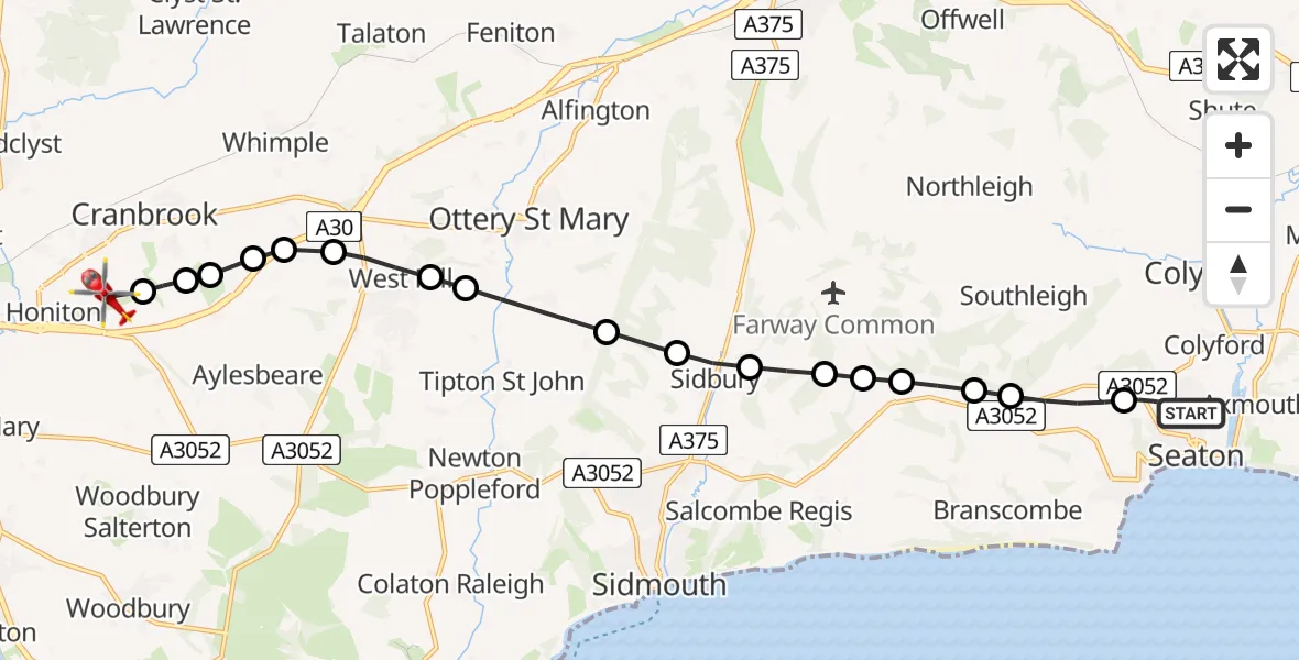
On Monday, 12 January 2026 at 2:21, a Air Ambulance Helicopter departed from Seaton to Exeter International Airport. It was the Air Ambulance Helicopter with registration number G-DAAS. The flight lasted 11 minutes. During that period, the aircraft travelled 15 miles at an average speed of 81 miles per hour at a maximum altitude of 2150 feet.
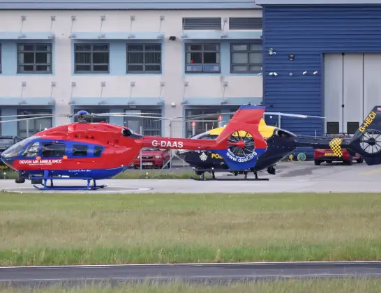
Helicopter: G-DAAS
The helicopter G-DAAS is used as a air ambulance helicopter. The main purpose of this aircraft is to transport a Mobile Medical Team to an incident as quickly as possible, enabling the trauma doctor to provide immediate first aid on site. The aircraft is flying this flight as Air Ambulance Helicopter.
Photo: Alan Wilson
16 miles
2150 feet
81 mph
12 minutes
02:21
02:32

Route
Exeter International Airport, Exeter, Devon02:32
Exeter International Airport, Exeter, Devon02:31
Rockbeare, East Devon02:31
Rockbeare, Exeter02:31
Rockbeare, East Devon02:31
Whimple, East Devon02:30
Rockbeare, East Devon02:30
West Hill, East Devon02:29
Tipton St John, East Devon02:29
Ottery St Mary, East Devon02:28
Sidmouth, East Devon02:28
Sidbury, Sidmouth02:27
Sidmouth, East Devon02:27
East Devon, Devon and Torbay02:26
Farway, East Devon02:26
East Devon, Devon and Torbay02:26
Southleigh, East Devon02:25
Colyford, East Devon02:24
Valley View, East Devon02:23
Seaton, East Devon02:21
Live flights
Today
Police Helicopter to Manchester Barton Aerodrome13 Jul 23:56
Police Helicopter to Bournemouth Airport13 Jul 23:55
Air Ambulance Helicopter to Cardiff Heliport13 Jul 23:38
Police Helicopter to Birmingham Airport13 Jul 23:21
Police Helicopter to Irlam, Twelve Yards Road13 Jul 23:00
Flights Seaton
Air Ambulance Helicopter to Seaton, Mabry Way13 Mar 19:42
Air Ambulance Helicopter to Seaton, Court Lane30 Jan 12:23
Air Ambulance Helicopter to Seaton, Valley View12 Jan 00:36
Helicopter flights on your website?
You can easily display helicopter flights on your own website. Use the embed code.
