Air Ambulance Helicopter to North Weald Airfield, North Weald Airfield
Sunday, 11 January 2026 | 15:58 | From Basildon
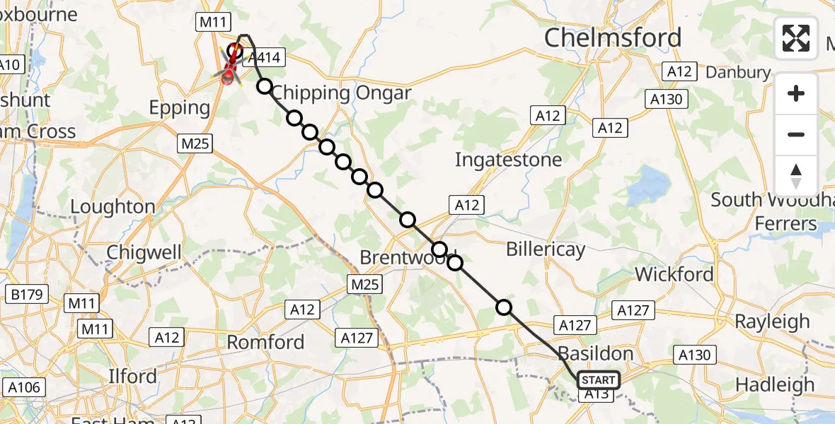
On Sunday, 11 January 2026 at 15:58, a Air Ambulance Helicopter departed from Basildon to North Weald Airfield. It was the Air Ambulance Helicopter with registration number G-EHAT. The flight lasted 9 minutes. During that period, the aircraft travelled 20 miles at an average speed of 137 miles per hour at a maximum altitude of 1225 feet.
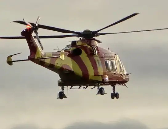
Helicopter: G-EHAT
The helicopter G-EHAT is used as a air ambulance helicopter. The main purpose of this aircraft is to transport a Mobile Medical Team to an incident as quickly as possible, enabling the trauma doctor to provide immediate first aid on site. The aircraft is flying this flight as Air Ambulance Helicopter.
Photo: By Steve Knight
21 miles
1225 feet
137 mph
9 minutes
15:58
16:07

Route
North Weald Airfield, Epping, Essex16:07
North Weald Airfield, Epping, Essex16:06
North Weald Bassett, Epping Forest16:05
Toot Hill, Epping Forest16:04
Stanford Rivers, Epping Forest16:04
Little End, Epping Forest16:04
Clapgate, Brentwood16:04
Kelvedon Hatch, Brentwood16:03
Coxtie Green, Brentwood16:03
Pilgrims' Hatch, Brentwood16:03
Brentwood, Essex16:02
Hutton, Brentwood16:02
Brentwood, Essex16:01
Nether Mayne, Essex15:58
Live flights
Today
Police Helicopter to Epping Forest, Green Lane26 Feb 23:43
Flights Basildon
Helicopter flights on your website?
You can easily display helicopter flights on your own website. Use the embed code.
