Coastguard Helicopter to Sandwith
Saturday, 10 January 2026 | 16:31 | From Wast Water
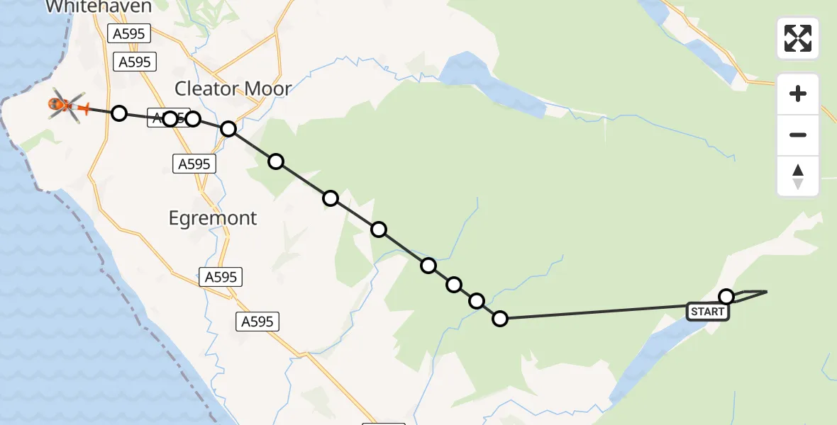
On Saturday, 10 January 2026 at 16:31, a Coastguard Helicopter departed from Wast Water to Sandwith. It was the Coastguard Helicopter with registration number G-MCGS. The flight lasted 10 minutes. During that period, the aircraft travelled 17 miles at an average speed of 105 miles per hour at a maximum altitude of 2100 feet.
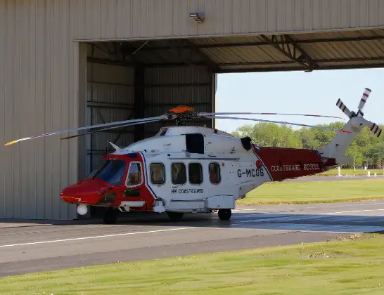
Helicopter: G-MCGS
The helicopter G-MCGS is used by the British Coastguard. The helicopter is deployed in search and rescue operations at sea, rescue operations involving ships or drilling platforms, patrols to prevent smuggling or piracy, environmental monitoring and disaster relief support.
18 miles
2100 feet
105 mph
11 minutes
16:31
16:41

Route
Sandwith, Whitehaven16:41
Sandwith, Whitehaven16:40
Bigrigg, Egremont16:40
Moor Row, Egremont16:40
Moor Row16:39
Cleator Moor16:39
Haile16:38
Ennerdale and Kinniside16:38
Ponsonby16:37
Ennerdale and Kinniside16:37
Wasdale16:37
Gosforth16:37
Wasdale, 16:31
Wasdale16:31
Wast Water16:31
Live flights
Police Helicopter on its way from MOD St Athan15 Jul 23:53
Police Helicopter on its way from Wrenthorpe15 Jul 23:36
Today
Police Helicopter to Glasgow, Renfrew Road15 Jul 23:45
Police Helicopter to Manchester Barton Aerodrome15 Jul 23:33
Police Helicopter to Renfrewshire15 Jul 23:32
Air Ambulance Helicopter to Southampton Airport15 Jul 23:30
Flights Sandwith
Coastguard Helicopter to Sandwith10 Jan 16:31
Helicopter flights on your website?
You can easily display helicopter flights on your own website. Use the embed code.
