Police Helicopter to Shere, Hound House Road
Saturday, 10 January 2026 | 14:12 | From Nutfield
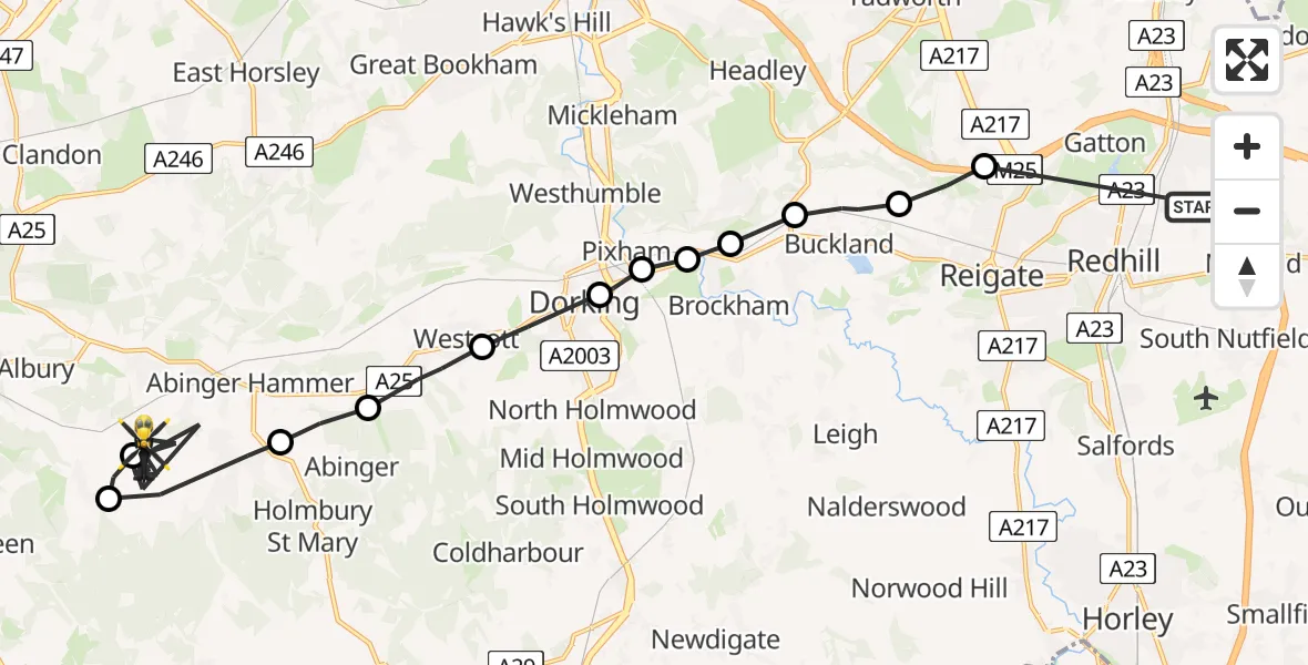
On Saturday, 10 January 2026 at 14:12, a Police Helicopter departed from Nutfield to Shere. It was the Police Helicopter with registration number G-POLH. The flight lasted 17 minutes. During that period, the aircraft travelled 22 miles at an average speed of 79 miles per hour at a maximum altitude of 1200 feet.
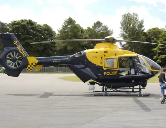
Helicopter: G-POLH
The helicopter G-POLH is used by the British police. The helicopter is deployed in pursuits, missing persons cases and other incidents where a helicopter provides added value.
Photo: Arpingstone
22 miles
1200 feet
79 mph
17 minutes
14:12
14:28

Route
Hound House Road, Guildford14:28
Shere, Guildford14:20
Guildford14:19
Shere, Guildford14:18
Abinger, Mole Valley14:17
Westcott, Mole Valley14:16
Dorking, Mole Valley14:16
Pixham, Mole Valley14:15
Brockham, Mole Valley14:15
Box Hill Village, Mole Valley14:15
Betchworth, Mole Valley14:15
Buckland, Mole Valley14:14
Lower Kingswood, Reigate and Banstead14:13
Nutfield Marsh Road, 14:12
Live flights
Today
Flights Shere
Police Helicopter to Shere, Towerhill Lane22 Feb 15:43
Police Helicopter to Salfords, Kings Mill Lane10 Jan 15:05
Police Helicopter to Shere, Hound House Road10 Jan 15:00
Police Helicopter to Shere, Hound House Road10 Jan 14:37
Police Helicopter to Shere, Towerhill Lane10 Jan 14:32
Police Helicopter to Shere, Hound House Road10 Jan 14:12
Flights Nutfield
Police Helicopter to Tandridge, Crab Hill Lane29 May 16:24
Police Helicopter to Redhill Aerodrome13 May 10:42
Police Helicopter to Tandridge, Crab Hill Lane12 May 17:53
Police Helicopter to Redhill Aerodrome9 May 17:37
Police Helicopter to Redhill Aerodrome19 Apr 19:25
Police Helicopter to Tandridge, Moats Lane19 Apr 14:53
Police Helicopter to Rochester Airport18 Apr 19:26
Helicopter flights on your website?
You can easily display helicopter flights on your own website. Use the embed code.
