Police Helicopter to Purbrook, Laburnum Road
Saturday, 10 January 2026 | 10:46 | From Hamble Airfield
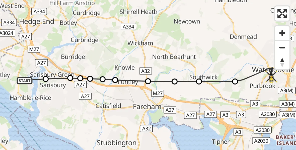
On Saturday, 10 January 2026 at 10:46, a Police Helicopter departed from Hamble Airfield to Purbrook. It was the Police Helicopter with registration number G-BZRS. The flight lasted 6 minutes. During that period, the aircraft travelled 13 miles at an average speed of 128 miles per hour at a maximum altitude of 1100 feet.
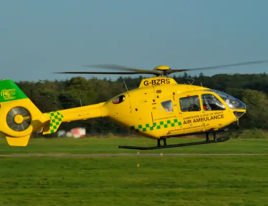
Helicopter: G-BZRS
The helicopter G-BZRS is used by the British police. The helicopter is deployed in pursuits, missing persons cases and other incidents where a helicopter provides added value.
Photo: NMOS332
13 miles
1100 feet
128 mph
7 minutes
10:46
10:52

Route
Laburnum Road, Havant10:52
Winchester10:50
Southwick, Winchester10:50
Winchester10:49
Fareham10:49
Funtley, Fareham10:48
Winchester10:48
Whiteley, Winchester10:47
Park Gate, Fareham10:47
Park Gate, Southampton10:47
Sarisbury Green, Fareham10:46
Hamble Airfield, Southampton, Hampshire10:46
Live flights
Today
Police Helicopter to Epping Forest, Green Lane26 Feb 23:43
Flights Purbrook
Police Helicopter to Purbrook, Laburnum Road10 Jan 10:46
Helicopter flights on your website?
You can easily display helicopter flights on your own website. Use the embed code.
