Coastguard Helicopter to Culcharry
Saturday, 10 January 2026 | 3:08 | From Dykes of Gray
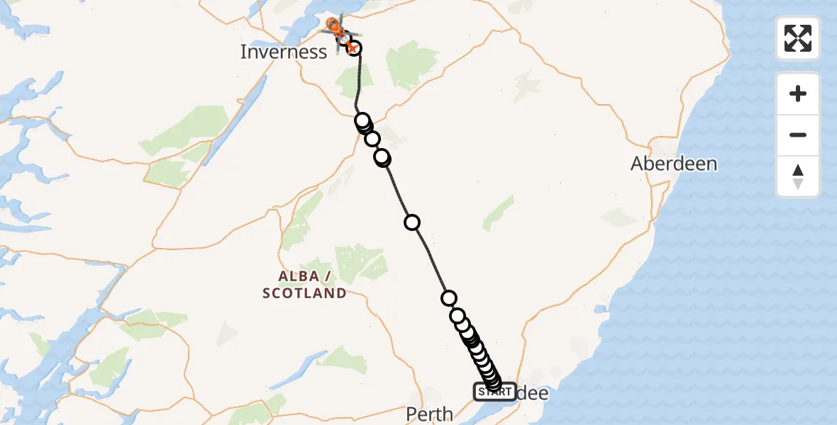
On Saturday, 10 January 2026 at 3:08, a Coastguard Helicopter departed from Dykes of Gray to Culcharry. It was the Coastguard Helicopter with registration number G-MCGT. The flight lasted 32 minutes. During that period, the aircraft travelled 81 miles at an average speed of 153 miles per hour at a maximum altitude of 6550 feet.
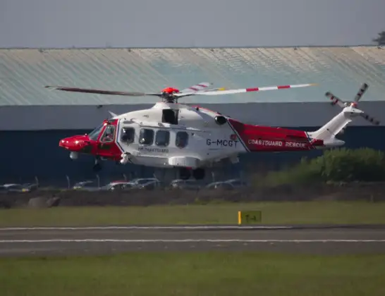
Helicopter: G-MCGT
The helicopter G-MCGT is used by the British Coastguard. The helicopter is deployed in search and rescue operations at sea, rescue operations involving ships or drilling platforms, patrols to prevent smuggling or piracy, environmental monitoring and disaster relief support.
Photo: Ronnie Macdonald
82 miles
6550 feet
153 mph
33 minutes
03:08
03:40

Route
Culcharry, 03:40
Culcharry03:40
Bruachmary03:39
Carrbridge03:33
Docharn03:33
Dulnain Bridge03:33
Boat of Garten03:32
Aviemore03:30
Glenmore03:30
Inverey03:25
Folda03:18
Kirkton of Glenisla03:17
Kilry03:16
Alyth03:15
New Alyth03:15
Alyth03:15
Ruthven03:14
Alyth03:14
Meigle03:13
Newtyle03:12
Auchterhouse03:11
Piperdam03:11
Lundie03:10
North Dronley03:10
Piperdam03:10
Liff03:09
Winding Path, 03:08
Live flights
Air Ambulance Helicopter on its way from Devizes14 Jul 22:59
Police Helicopter on its way from Thames View14 Jul 22:44
Police Helicopter on its way from Brandy Carr14 Jul 22:00
Today
Air Ambulance Helicopter to Cardiff Heliport14 Jul 22:43
Coastguard Helicopter to North Sea14 Jul 22:40
Air Ambulance Helicopter to North Sea14 Jul 22:27
Air Ambulance Helicopter to Priory Farm Airstrip14 Jul 22:16
Air Ambulance Helicopter to Papworth Hospital14 Jul 22:02
Air Ambulance Helicopter to Redhill Aerodrome14 Jul 21:58
Coastguard Helicopter to North Sea14 Jul 21:56
Flights Culcharry
Air Ambulance Helicopter to Culcharry, B909029 Jun 03:47
Coastguard Helicopter to Culcharry10 Jan 03:08
Helicopter flights on your website?
You can easily display helicopter flights on your own website. Use the embed code.
