Air Ambulance Helicopter to Earls Colne Airfield
Friday, 3 July 2026 | 13:54 | From Epping Forest
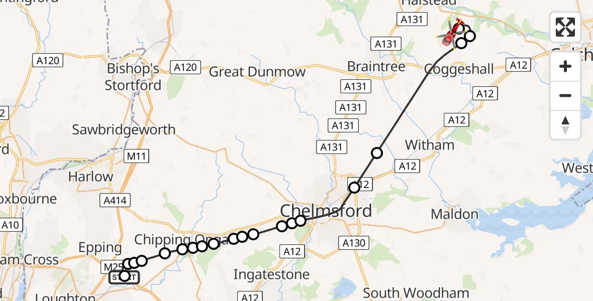
On Friday, 3 July 2026 at 13:54, a Air Ambulance Helicopter departed from Epping Forest to Earls Colne Airfield. It was the Air Ambulance Helicopter with registration number G-EHAT. The flight lasted 18 minutes. During that period, the aircraft travelled 33 miles at an average speed of 108 miles per hour at a maximum altitude of 800 feet.
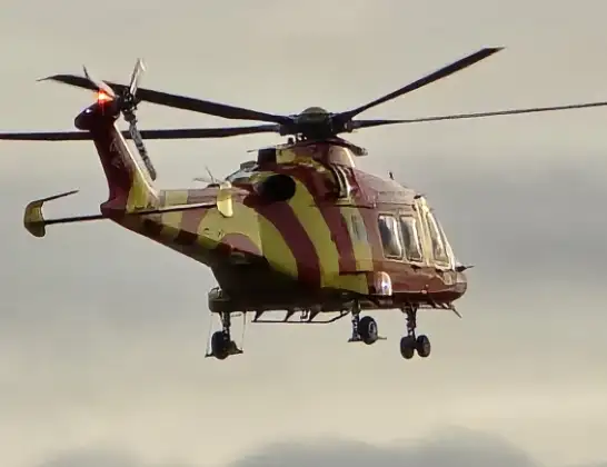
Helicopter: G-EHAT
The helicopter G-EHAT is used as a air ambulance helicopter. The main purpose of this aircraft is to transport a Mobile Medical Team to an incident as quickly as possible, enabling the trauma doctor to provide immediate first aid on site. The aircraft is flying this flight as Air Ambulance Helicopter.
Photo: By Steve Knight
34 miles
800 feet
108 mph
19 minutes
13:54
14:12

Route
Earls Colne Airfield, Colchester, Essex14:12
Earls Colne Airfield, Colchester, Essex14:11
Braintree, Essex14:10
Coggeshall, Essex14:09
Braintree, Essex14:06
Boreham, Essex14:05
Chelmsford, Essex14:03
Highwood, Essex14:02
Chelmsford, Essex14:02
Highwood, Essex14:01
Chelmsford, Essex14:01
Brentwood, Essex14:01
Norton Heath, Essex14:00
High Ongar, Essex14:00
Brentwood, Essex14:00
Little End, Essex14:00
Stanford Rivers, Essex13:59
Toot Hill, Essex13:58
Stapleford Tawney, Essex13:58
Woodhatch, Essex13:58
Former Roman Road, Essex13:58
Theydon Garnon, Essex13:54
Epping Forest, Essex13:54
Live flights
Today
Police Helicopter to RAF Benson14:12:46
Helicopter flights on your website?
You can easily display helicopter flights on your own website. Use the embed code.
