Air Ambulance Helicopter to East Harling, Quidenham Road
Tuesday, 19 May 2026 | 9:59 | From Norwich Airport
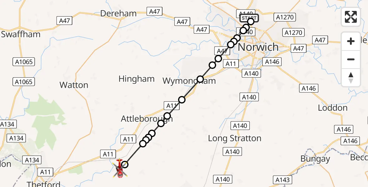
On Tuesday, 19 May 2026 at 9:59, a Air Ambulance Helicopter departed from Norwich Airport to East Harling. It was the Air Ambulance Helicopter with registration number G-RESU. The flight lasted 17 minutes. During that period, the aircraft travelled 23 miles at an average speed of 84 miles per hour at a maximum altitude of 875 feet.
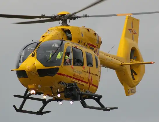
Helicopter: G-RESU
The helicopter G-RESU is used as a air ambulance helicopter. The main purpose of this aircraft is to transport a Mobile Medical Team to an incident as quickly as possible, enabling the trauma doctor to provide immediate first aid on site. The aircraft is flying this flight as Air Ambulance Helicopter.
Photo: Mike Burdett
24 miles
875 feet
84 mph
17 minutes
09:59
10:16

Route
Quidenham Road, Norfolk10:16
East Harling, Norfolk10:15
Breckland, Norfolk10:13
Old Buckenham, Norfolk10:13
Attleborough, Norfolk10:13
Old Buckenham, Norfolk10:12
Attleborough, Norfolk10:12
Besthorpe, Norfolk10:11
Spooner Row, Norfolk10:10
Wymondham, Norfolk10:08
Hethersett, Norfolk10:07
Little Melton, Norfolk10:07
Colney, Norfolk10:06
Norwich, Norfolk10:06
Costessey, Norfolk10:05
Broadland, Norfolk10:05
Norwich, Norfolk10:05
Broadland, Norfolk10:04
Norwich Airport, Norwich, Norfolk10:01
Norwich Airport, Norwich, Norfolk09:59
Live flights
Today
Helicopter flights on your website?
You can easily display helicopter flights on your own website. Use the embed code.
