Coastguard Drone to Swingate Airfield
Friday, 8 May 2026 | 1:54 | From Langdon Battery Heliport
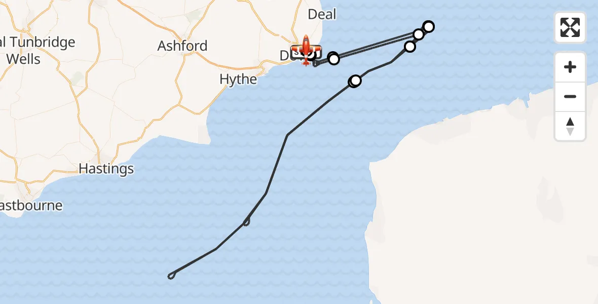
On Friday, 8 May 2026 at 1:54, a Coastguard Drone departed from Langdon Battery Heliport to Swingate Airfield. It was the Coastguard Drone with registration number G-UASE. The flight lasted 240 minutes. During that period, the aircraft travelled 268 miles at an average speed of 67 miles per hour at a maximum altitude of 1325 feet.
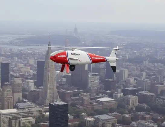
Helicopter: G-UASE
The drone G-UASE is used by the British Coastguard. The drone is deployed in search and rescue operations at sea, rescue operations involving ships or drilling platforms, patrols to prevent smuggling or piracy, environmental monitoring and disaster relief support.
Photo: Tony Melony
268 miles
1325 feet
67 mph
241 minutes
01:54
05:54

Route
Swingate Airfield, Swingate05:54
Swingate Airfield, Swingate05:53
Dover, Kent05:51
English Channel05:45
North Sea05:36
Noordzee05:34
North Sea05:19
English Channel04:23
North Sea04:12
Noordzee04:08
North Sea03:54
English Channel02:35
North Sea02:25
Noordzee02:21
North Sea02:04
English Channel01:57
Langdon Stairs, Kent01:56
Dover, Kent01:56
Swingate Airfield, Swingate01:54
Langdon Battery Heliport, St. Margaret's at Cliffe, Dover01:54
Live flights
Today
Helicopter flights on your website?
You can easily display helicopter flights on your own website. Use the embed code.
