Police Helicopter to Bristol Channel
Monday, 4 May 2026 | 23:43 | From MOD St Athan
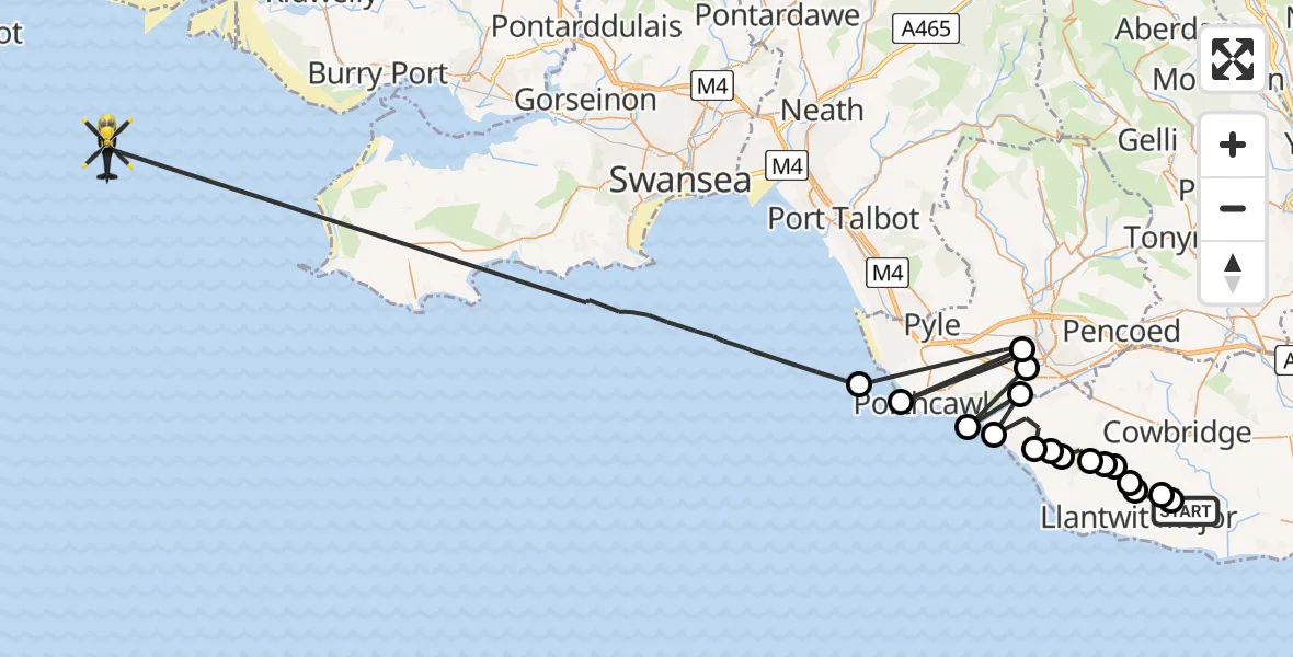
On Monday, 4 May 2026 at 23:43, a Police Helicopter departed from MOD St Athan to Bristol Channel. It was the Police Helicopter with registration number G-NWOI. The flight lasted 20 minutes. During that period, the aircraft travelled 73 miles at an average speed of 222 miles per hour at a maximum altitude of 1450 feet.
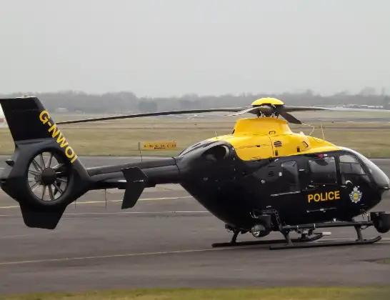
Helicopter: G-NWOI
The helicopter G-NWOI is used by the British police. The helicopter is deployed in pursuits, missing persons cases and other incidents where a helicopter provides added value.
Photo: James from Cheltenham
73 miles
1450 feet
222 mph
20 minutes
23:43
00:03

Route
Bristol Channel, 00:03
Bristol Channel23:49
Bryntirion, Bridgend23:49
Porthcawl, Bridgend23:49
Bryntirion, Bridgend23:48
Newton, Bridgend23:47
Merthyr Mawr, Bridgend23:47
Ogmore-by-Sea, Vale of Glamorgan23:47
St Brides Major, Vale of Glamorgan23:46
St. Brides Major, Vale of Glamorgan23:46
St Brides Major, Vale of Glamorgan23:46
Wick, Vale of Glamorgan23:45
Llandow, Vale of Glamorgan23:45
Llantwit Major, Vale of Glamorgan23:45
Sigingstone, Vale of Glamorgan23:44
Llantwit Major, Vale of Glamorgan23:44
Llanmaes, Vale of Glamorgan23:44
Eglwys Brewis, Vale of Glamorgan23:44
MOD St Athan, St Athan, Vale of Glamorgan23:43
Live flights
Today
Helicopter flights on your website?
You can easily display helicopter flights on your own website. Use the embed code.
