Police Helicopter to Salfords, Axes Lane
Monday, 4 May 2026 | 23:13 | From Little Horsted
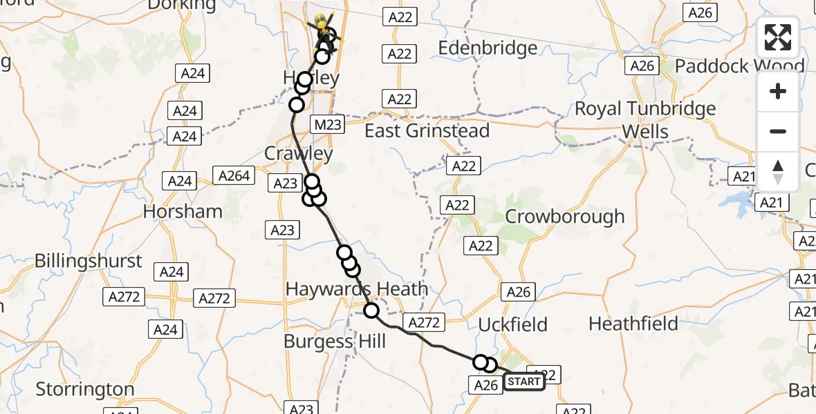
On Monday, 4 May 2026 at 23:13, a Police Helicopter departed from Little Horsted to Salfords. It was the Police Helicopter with registration number G-POLH. The flight lasted 14 minutes. During that period, the aircraft travelled 29 miles at an average speed of 127 miles per hour at a maximum altitude of 1300 feet.
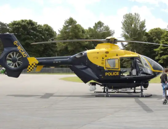
Helicopter: G-POLH
The helicopter G-POLH is used by the British police. The helicopter is deployed in pursuits, missing persons cases and other incidents where a helicopter provides added value.
Photo: Arpingstone
29 miles
1300 feet
127 mph
14 minutes
23:13
23:27

Route
Axes Lane, Surrey23:27
Tandridge, Surrey23:27
Salfords, Surrey23:26
Horley, Surrey23:26
Salfords, Surrey23:26
Horley, Surrey23:24
Hookwood, Surrey23:24
London Gatwick Airport, London23:24
Crawley, West Sussex23:22
Slaugham, West Sussex23:21
Balcombe, West Sussex23:21
Slaugham, West Sussex23:21
Balcombe, West Sussex23:20
Cuckfield, West Sussex23:19
Mid Sussex, West Sussex23:19
Haywards Heath, West Sussex23:18
Lewes, East Sussex23:15
Isfield, East Sussex23:14
Harveys Lane, East Sussex23:13
Live flights
Today
Flights Salfords
Air Ambulance Helicopter to Redhill Aerodrome11 Jul 14:04
Police Helicopter to North Weald Bassett28 Jun 14:38
Air Ambulance Helicopter to Redhill Aerodrome10 Jun 09:33
Police Helicopter to Aldenham, Wards Lane8 Jun 08:55
Police Helicopter to South Nutfield, M236 Jun 19:01
Police Helicopter to Redhill Aerodrome6 Jun 00:03
Police Helicopter to Fishbourne, Westgate4 Jun 11:45
Helicopter flights on your website?
You can easily display helicopter flights on your own website. Use the embed code.
