Air Ambulance Helicopter to St. Helens, St Helen's Beach Promenade
Monday, 4 May 2026 | 12:33 | From Queen Alexandra Hospital
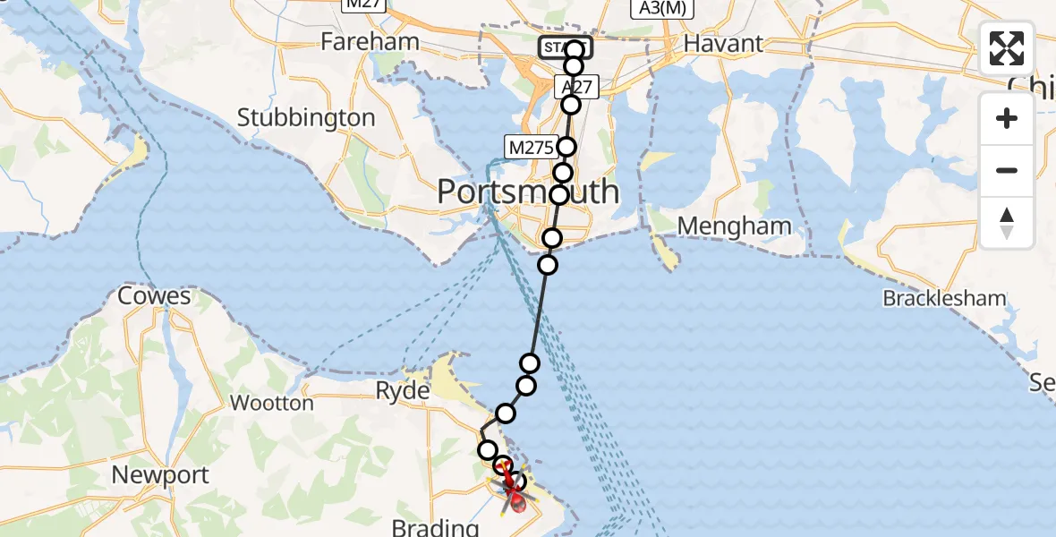
On Monday, 4 May 2026 at 12:33, a Air Ambulance Helicopter departed from Queen Alexandra Hospital to St. Helens. It was the Air Ambulance Helicopter with registration number G-HIOW. The flight lasted 8 minutes. During that period, the aircraft travelled 13 miles at an average speed of 95 miles per hour at a maximum altitude of 1050 feet.
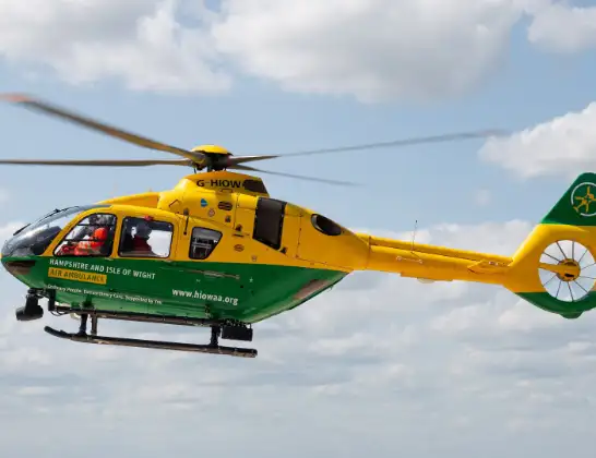
Helicopter: G-HIOW
The helicopter G-HIOW is used as a air ambulance helicopter. The main purpose of this aircraft is to transport a Mobile Medical Team to an incident as quickly as possible, enabling the trauma doctor to provide immediate first aid on site. The aircraft is flying this flight as Air Ambulance Helicopter.
Photo: JF2608
13 miles
1050 feet
95 mph
9 minutes
12:33
12:41

Route
St. Helens, Isle of Wight12:41
St Helen's Beach Promenade, Isle of Wight12:41
St. Helens, Isle of Wight12:39
Ryde, Isle of Wight12:39
Nettlestone, Isle of Wight12:39
Seaview, Isle of Wight12:38
English Channel12:38
No Man's Fort Helipad, Southampton12:38
English Channel12:36
Fratton, Portsmouth12:36
Somers Town, Portsmouth12:36
Fratton, Portsmouth12:35
Buckland, Portsmouth12:35
Tipner, Portsmouth12:35
Magdala Road, Portsmouth12:34
Cosham, Portsmouth12:34
Queen Alexandra Hospital, Portsmouth12:33
Live flights
Today
Coastguard Helicopter to Corrie15:48:56
Helicopter flights on your website?
You can easily display helicopter flights on your own website. Use the embed code.
