Air Ambulance Helicopter to Cambridge City Airport
Sunday, 3 May 2026 | 14:49 | From Haverhill
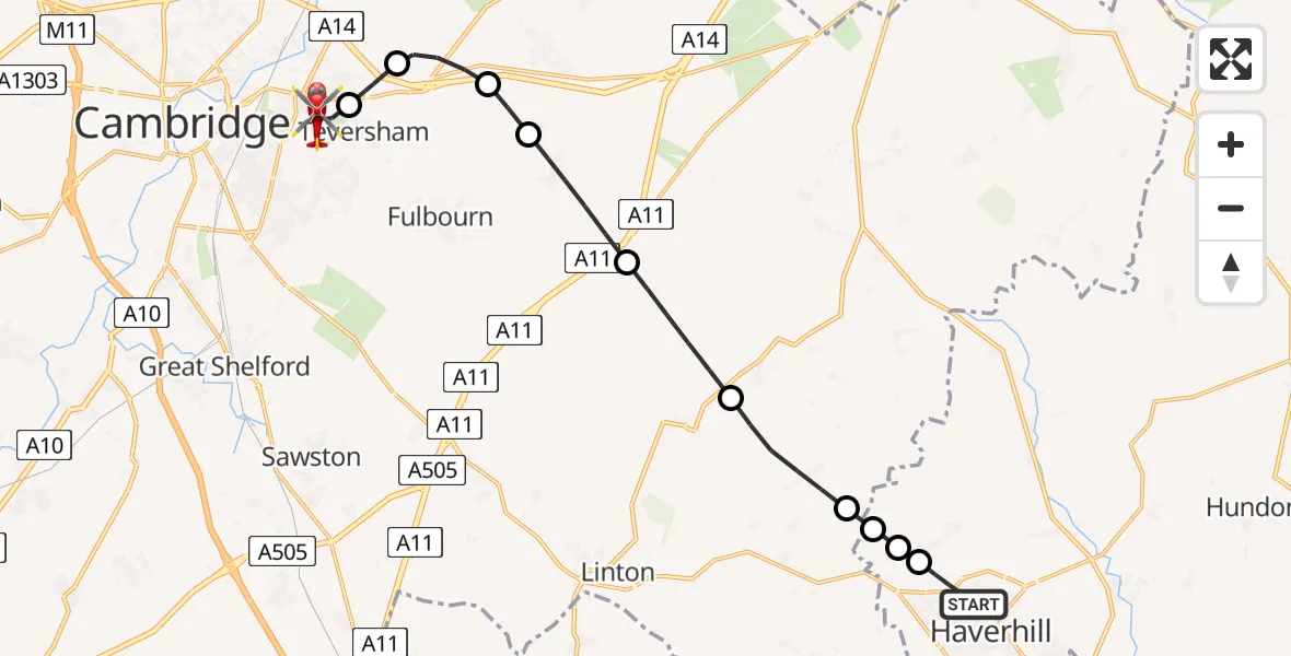
On Sunday, 3 May 2026 at 14:49, a Air Ambulance Helicopter departed from Haverhill to Cambridge City Airport. It was the Air Ambulance Helicopter with registration number G-RESU. The flight lasted 11 minutes. During that period, the aircraft travelled 15 miles at an average speed of 85 miles per hour at a maximum altitude of 1625 feet.
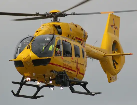
Helicopter: G-RESU
The helicopter G-RESU is used as a air ambulance helicopter. The main purpose of this aircraft is to transport a Mobile Medical Team to an incident as quickly as possible, enabling the trauma doctor to provide immediate first aid on site. The aircraft is flying this flight as Air Ambulance Helicopter.
Photo: Mike Burdett
16 miles
1625 feet
85 mph
11 minutes
14:49
15:00

Route
Cambridge City Airport, Cambridge, Cambridgeshire15:00
Cambridge City Airport, Cambridge, Cambridgeshire14:58
Fen Ditton, Cambridgeshire14:57
Stow cum Quy, Cambridgeshire14:56
Little Wilbraham, Cambridgeshire14:55
Great Wilbraham, Cambridgeshire14:54
West Wratting, Cambridgeshire14:53
West Wickham, Cambridgeshire14:51
Withersfield, Suffolk14:51
Haverhill, Suffolk14:51
Withersfield, Suffolk14:51
Howe Road, Suffolk14:49
Live flights
Today
Flights Haverhill
Helicopter flights on your website?
You can easily display helicopter flights on your own website. Use the embed code.
