Air Ambulance Helicopter to Great Thirkleby, Low Road
Sunday, 3 May 2026 | 9:47 | From Nawton
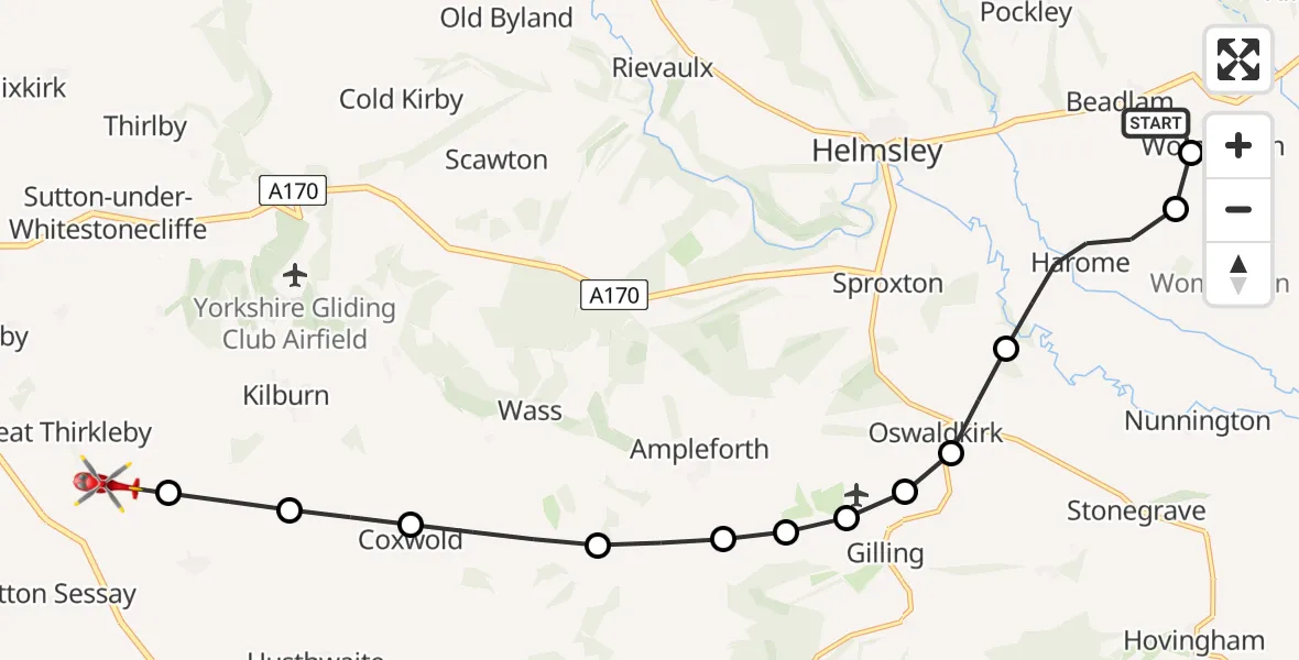
On Sunday, 3 May 2026 at 9:47, a Air Ambulance Helicopter departed from Nawton to Great Thirkleby. It was the Air Ambulance Helicopter with registration number G-YORX. The flight lasted 7 minutes. During that period, the aircraft travelled 14 miles at an average speed of 118 miles per hour at a maximum altitude of 1125 feet.
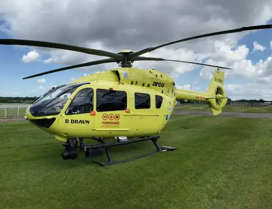
Helicopter: G-YORX
The helicopter G-YORX is used as a air ambulance helicopter. The main purpose of this aircraft is to transport a Mobile Medical Team to an incident as quickly as possible, enabling the trauma doctor to provide immediate first aid on site. The aircraft is flying this flight as Air Ambulance Helicopter.
Photo: Arollin96227
15 miles
1125 feet
118 mph
8 minutes
09:47
09:54

Route
Low Road, North Yorkshire09:54
Great Thirkleby, North Yorkshire09:54
Carlton Husthwaite, North Yorkshire09:53
Coxwold, North Yorkshire09:53
Newburgh, North Yorkshire09:52
Ampleforth, North Yorkshire09:52
Gilling East, North Yorkshire09:51
Lodge Field House Airstrip, Gilling East, Yorkshire09:51
Gilling East, North Yorkshire09:51
Oswaldkirk, North Yorkshire09:51
Stonegrave, North Yorkshire09:50
Harome, North Yorkshire09:49
Lowfield Lane, North Yorkshire09:49
Nawton, North Yorkshire09:47
Live flights
Today
Flights Nawton
Helicopter flights on your website?
You can easily display helicopter flights on your own website. Use the embed code.
