Coastguard Helicopter to Crantock, West Pentire Road
Friday, 1 May 2026 | 20:30 | From Cornwall Airport Newquay
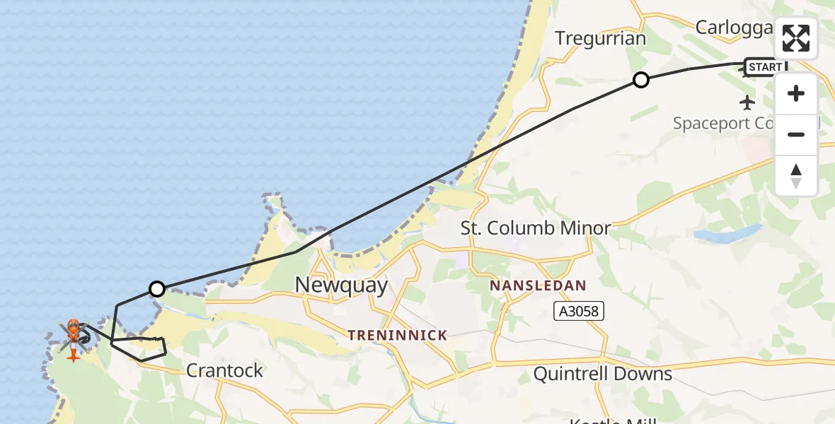
On Friday, 1 May 2026 at 20:30, a Coastguard Helicopter departed from Cornwall Airport Newquay to Crantock. It was the Coastguard Helicopter with registration number G-MCGI. The flight lasted 19 minutes. During that period, the aircraft travelled 9 miles at an average speed of 30 miles per hour at a maximum altitude of 600 feet.
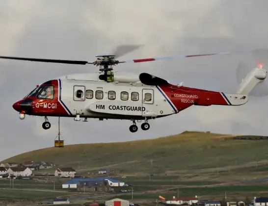
Helicopter: G-MCGI
The helicopter G-MCGI is used by the British Coastguard. The helicopter is deployed in search and rescue operations at sea, rescue operations involving ships or drilling platforms, patrols to prevent smuggling or piracy, environmental monitoring and disaster relief support.
Photo: CG Rescue G-MCGI MG 0869.jpg by Ronnie Robertson Licensed under CC BY-SA 2.0 Source: https://commons.wikimedia.org/wiki/File:CG_Rescue_G-MCGI_MG_0869.jpg
10 miles
600 feet
30 mph
19 minutes
20:30
20:49

Route
West Pentire Road, Cornwall20:49
Crantock, Cornwall20:38
Newquay, Cornwall20:36
Cornwall Airport Newquay, Newquay20:35
Cornwall Airport Newquay, Newquay20:30
Live flights
Today
Police Helicopter to North Weald Airfield1 May 23:59
Police Helicopter to MOD St Athan1 May 23:36
Air Ambulance Helicopter to Cardiff Heliport1 May 22:51
Police Helicopter to Harborough, Sulby Road1 May 22:48
Air Ambulance Helicopter to Glasgow Airport1 May 22:46
Coastguard Helicopter to Inverness Airport1 May 22:35
Flights Crantock
Helicopter flights on your website?
You can easily display helicopter flights on your own website. Use the embed code.
