Coastguard Drone to Dover, Langdon Stairs
Friday, 1 May 2026 | 11:03 | From Noordzee
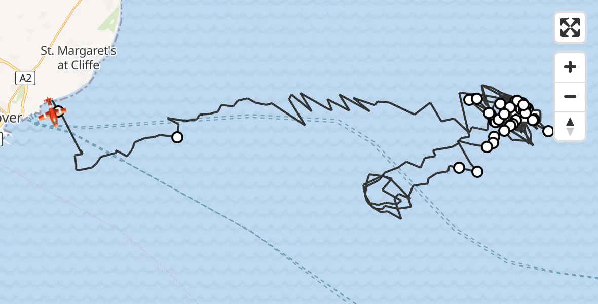
On Friday, 1 May 2026 at 11:03, a Coastguard Drone departed from Noordzee to Dover. It was the Coastguard Drone with registration number G-UASA. The flight lasted 66 minutes. During that period, the aircraft travelled 101 miles at an average speed of 93 miles per hour at a maximum altitude of 1200 feet.
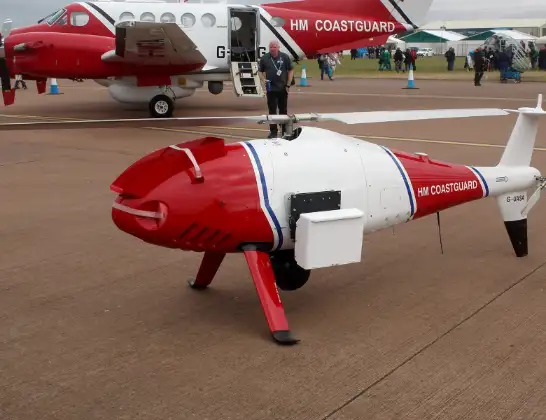
Helicopter: G-UASA
The drone G-UASA is used by the British Coastguard. The drone is deployed in search and rescue operations at sea, rescue operations involving ships or drilling platforms, patrols to prevent smuggling or piracy, environmental monitoring and disaster relief support.
Photo: Mike Burdett, CROMER, UK
102 miles
1200 feet
93 mph
66 minutes
11:03
12:09

Route
Langdon Stairs, Kent12:09
Dover, Kent12:08
English Channel12:01
North Sea11:50
Noordzee11:50
North Sea11:50
Noordzee11:49
North Sea11:48
Noordzee11:46
North Sea11:44
Noordzee11:42
North Sea11:41
Noordzee11:40
North Sea11:39
Noordzee11:39
North Sea11:38
Noordzee11:36
North Sea11:35
Noordzee11:35
North Sea11:34
Noordzee11:32
North Sea11:16
Noordzee11:16
North Sea11:15
Noordzee11:15
North Sea11:14
Noordzee11:13
North Sea11:12
Noordzee11:12
North Sea11:11
Noordzee11:10
North Sea11:09
Noordzee11:06
North Sea11:04
Noordzee, 11:03
Live flights
Today
Police Helicopter to Lough Neagh19:43:03
Flights Dover
Coastguard Drone to Dover, A27 Jul 10:30
Coastguard Drone to Dover, Ardent Road7 Jul 08:02
Coastguard Drone to Swingate Airfield7 Jul 02:55
Coastguard Helicopter to Manston Airport6 Jul 15:24
Coastguard Drone to Dover, Sandwich Road5 Jul 09:13
Coastguard Drone to Dover, Manley Close5 Jul 09:06
Coastguard Drone to Dover, Manley Close5 Jul 07:46
Coastguard Drone to Dover, Manley Close3 Jul 11:40
Flights Noordzee
Coastguard Drone to English Channel3 Jul 12:24
Coastguard Drone to Noordzee3 Jul 12:17
Coastguard Drone to Noordzee29 Jun 07:45
Coastguard Drone to Noordzee29 Jun 07:42
Coastguard Drone to Noordzee21 Jun 11:39
Coastguard Drone to Noordzee21 Jun 11:35
Coastguard Drone to Noordzee21 Jun 11:30
Coastguard Drone to Noordzee21 Jun 11:27
Coastguard Drone to Noordzee21 Jun 11:22
Coastguard Drone to Noordzee21 Jun 11:19
Helicopter flights on your website?
You can easily display helicopter flights on your own website. Use the embed code.
