Police Helicopter to North Weald Airfield
Friday, 1 May 2026 | 6:13 | From High Ongar
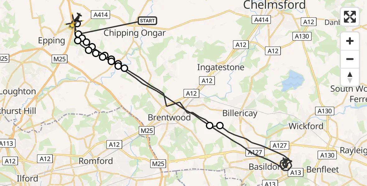
On Friday, 1 May 2026 at 6:13, a Police Helicopter departed from High Ongar to North Weald Airfield. It was the Police Helicopter with registration number G-POLD. The flight lasted 24 minutes. During that period, the aircraft travelled 51 miles at an average speed of 126 miles per hour at a maximum altitude of 1300 feet.
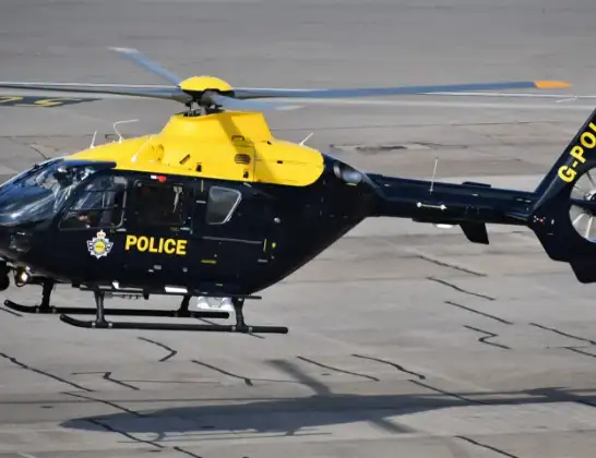
Helicopter: G-POLD
The helicopter G-POLD is used by the British police. The helicopter is deployed in pursuits, missing persons cases and other incidents where a helicopter provides added value.
Photo: Alec Wilson
51 miles
1300 feet
126 mph
25 minutes
06:13
06:37

Route
North Weald Airfield, Epping, Essex06:37
North Weald Airfield, Epping, Essex06:36
Coopersale, Essex06:35
Woodhatch, Essex06:34
Toot Hill, Essex06:34
Epping Forest, Essex06:34
Stanford Rivers, Essex06:34
Little End, Essex06:33
Brentwood, Essex06:30
Basildon, Essex06:18
Brentwood, Essex06:15
Little End, Essex06:15
Stanford Rivers, Essex06:14
Epping Forest, Essex06:14
Toot Hill, Essex06:14
Stapleford Tawney, Essex06:13
Woodhatch, Essex06:13
Coopersale, Essex06:13
Forest Lodge Road, Essex06:13
Live flights
Today
Helicopter flights on your website?
You can easily display helicopter flights on your own website. Use the embed code.
