Air Ambulance Helicopter to Tunbridge Wells Hospital Heliport
Friday, 1 May 2026 | 4:37 | From Royal Tunbridge Wells
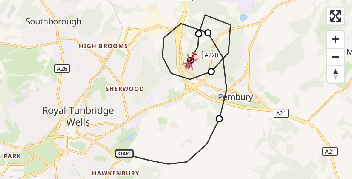
On Friday, 1 May 2026 at 4:37, a Air Ambulance Helicopter departed from Royal Tunbridge Wells to Tunbridge Wells Hospital Heliport. It was the Air Ambulance Helicopter with registration number G-KSSC. The flight lasted 10 minutes. During that period, the aircraft travelled 7 miles at an average speed of 44 miles per hour at a maximum altitude of 1025 feet.
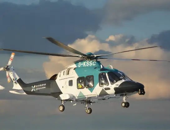
Helicopter: G-KSSC
The helicopter G-KSSC is used as a air ambulance helicopter. The main purpose of this aircraft is to transport a Mobile Medical Team to an incident as quickly as possible, enabling the trauma doctor to provide immediate first aid on site. The aircraft is flying this flight as Air Ambulance Helicopter.
Photo: Shona aakss
8 miles
1025 feet
44 mph
11 minutes
04:37
04:48

Route
Tunbridge Wells Hospital Heliport, Tunbridge Wells, Kent04:48
Tunbridge Wells Hospital Heliport, Tunbridge Wells, Kent04:48
Royal Tunbridge Wells, Kent04:46
Pembury, Kent04:45
Royal Tunbridge Wells, Kent04:44
Pembury, Kent04:43
Halls Hole Road, Kent04:39
Royal Tunbridge Wells, Kent04:37
Live flights
Today
Police Helicopter to Glasgow, South Street6 Jul 23:22
Police Helicopter to South Lanarkshire6 Jul 23:09
Police Helicopter to North Weald Airfield6 Jul 22:57
Police Aircraft to East Midlands Airport6 Jul 22:56
Police Helicopter to Lochhead, A726 Jul 22:39
Helicopter flights on your website?
You can easily display helicopter flights on your own website. Use the embed code.
