Air Ambulance Helicopter to Bracknell, Ringmead
Thursday, 30 April 2026 | 15:52 | From RAF Benson
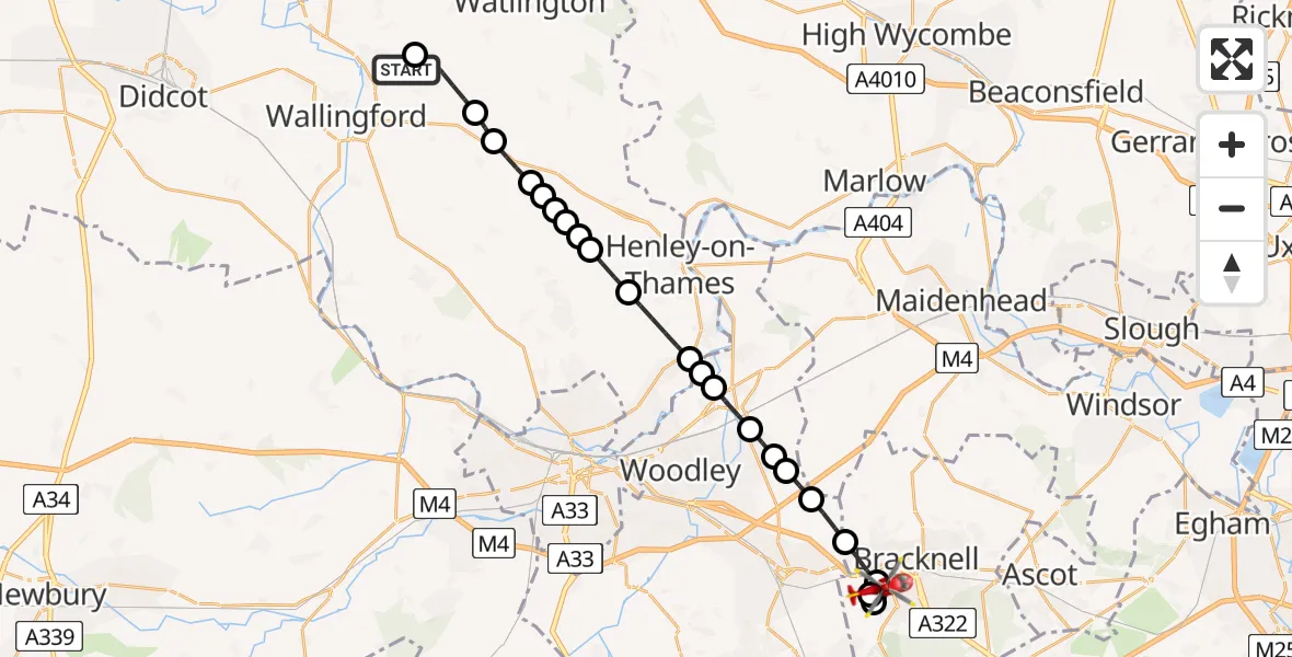
On Thursday, 30 April 2026 at 15:52, a Air Ambulance Helicopter departed from RAF Benson to Bracknell. It was the Air Ambulance Helicopter with registration number G-TVLY. The flight lasted 14 minutes. During that period, the aircraft travelled 23 miles at an average speed of 101 miles per hour at a maximum altitude of 1250 feet.
Helicopter: G-TVLY
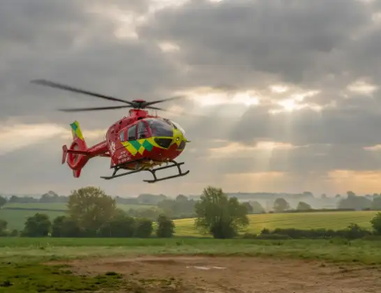
The helicopter G-TVLY is used as a air ambulance helicopter. The main purpose of this aircraft is to transport a Mobile Medical Team to an incident as quickly as possible, enabling the trauma doctor to provide immediate first aid on site. The aircraft is flying this flight as Air Ambulance Helicopter.
Photo: Tony Melony
24 miles
1250 feet
101 mph
14 minutes
15:52
16:06

Route
Ringmead, Bracknell Forest16:06
Bracknell, Bracknell Forest16:05
Wokingham, Bracknell Forest16:05
Bracknell, Bracknell Forest16:03
Binfield, Bracknell Forest16:02
St. Nicholas, Hurst, Wokingham16:01
Waltham St. Lawrence, Wokingham16:01
Hurst, Wokingham16:01
Twyford, Wokingham16:00
Charvil, Wokingham15:59
Wargrave, Wokingham15:59
Shiplake, Oxfordshire15:59
Henley-on-Thames, Oxfordshire15:58
Rotherfield Greys, Oxfordshire15:57
Highmoor, Oxfordshire15:57
South Oxfordshire, Oxfordshire15:56
Highmoor, Oxfordshire15:56
Nettlebed, Oxfordshire15:56
South Oxfordshire, Oxfordshire15:56
Nuffield, Oxfordshire15:55
South Oxfordshire, Oxfordshire15:54
Ewelme, Oxfordshire15:53
RAF Benson, Wallingford, Oxfordshire15:52
RAF Benson, Wallingford, Oxfordshire15:52
Live flights
Today
Police Helicopter to Manchester Barton Aerodrome31 Jul 23:15
Air Ambulance Helicopter to Cardiff Heliport31 Jul 23:05
Police Helicopter to Glasgow, Helen Street31 Jul 23:03
Police Helicopter to Inner Seas31 Jul 22:56
Air Ambulance Helicopter to Trispen, A3931 Jul 22:54
Flights Bracknell
Air Ambulance Helicopter to RAF Benson8 Jul 15:03
Air Ambulance Helicopter to Oxford, Headley Way28 Jun 19:18
Police Helicopter to Bracknell, Berkshire Way25 May 17:32
Helicopter flights on your website?
You can easily display helicopter flights on your own website. Use the embed code.
