Police Helicopter to MOD St Athan
Thursday, 30 April 2026 | 14:29 | From MOD St Athan
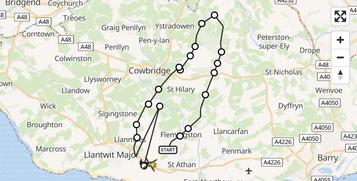
On Thursday, 30 April 2026 at 14:29, a Police Helicopter departed from MOD St Athan to MOD St Athan. It was the Police Helicopter with registration number G-NWOI. The flight lasted 8 minutes. During that period, the aircraft travelled 20 miles at an average speed of 159 miles per hour at a maximum altitude of 1125 feet.
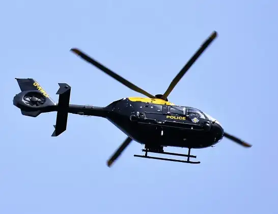
Helicopter: G-NWOI
The helicopter G-NWOI is used by the British police. The helicopter is deployed in pursuits, missing persons cases and other incidents where a helicopter provides added value.
Photo: Alec Wilson
20 miles
1125 feet
159 mph
8 minutes
14:29
14:36

Route
MOD St Athan, St Athan, Vale of Glamorgan14:36
MOD St Athan, St Athan, Vale of Glamorgan14:36
Cowbridge, Vale of Glamorgan14:36
Boverton, Vale of Glamorgan14:35
Llanmaes, Vale of Glamorgan14:35
St Mary Church, Vale of Glamorgan14:34
Llanfair, Vale of Glamorgan14:34
Aberthin, Vale of Glamorgan14:33
St Hilary, Vale of Glamorgan14:33
Aberthin, Vale of Glamorgan14:33
Welsh St. Donats, Vale of Glamorgan14:33
Ystradowen, Vale of Glamorgan14:32
Miskin, Vale of Glamorgan14:32
Pendoylan, Vale of Glamorgan14:31
Welsh St. Donats, Vale of Glamorgan14:31
St Hilary, Vale of Glamorgan14:31
Bonvilston, Vale of Glamorgan14:30
Llancarfan, Vale of Glamorgan14:29
Flemingston, Vale of Glamorgan14:29
MOD St Athan, St Athan, Vale of Glamorgan14:29
Live flights
Today
Helicopter flights on your website?
You can easily display helicopter flights on your own website. Use the embed code.
