Police Helicopter to High Ongar, Forest Lodge Road
Thursday, 30 April 2026 | 12:16 | From North Weald Bassett
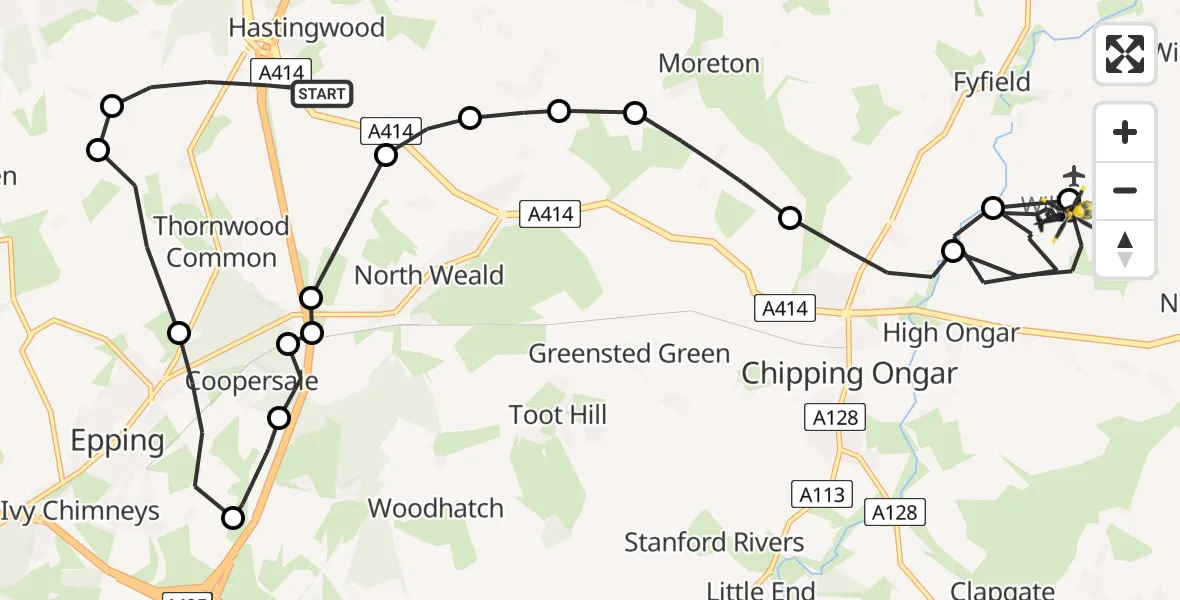
On Thursday, 30 April 2026 at 12:16, a Police Helicopter departed from North Weald Bassett to High Ongar. It was the Police Helicopter with registration number G-POLU. The flight lasted 22 minutes. During that period, the aircraft travelled 19 miles at an average speed of 52 miles per hour at a maximum altitude of 1900 feet.
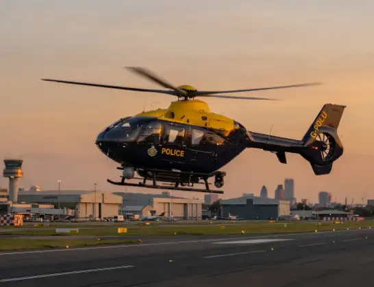
Helicopter: G-POLU
The helicopter G-POLU is used by the British police. The helicopter is deployed in pursuits, missing persons cases and other incidents where a helicopter provides added value.
Photo: Tony Melony
19 miles
1900 feet
52 mph
23 minutes
12:16
12:38

Route
Forest Lodge Road, Essex12:38
High Ongar, Essex12:35
Willingale Airstrip, Ongar, Essex12:35
High Ongar, Essex12:34
Chipping Ongar, Essex12:33
Moreton, Essex12:32
Magdalen Laver, Essex12:31
Epping Forest, Essex12:31
North Weald Bassett, Essex12:30
North Weald Airfield, Epping, Essex12:21
Coopersale, Essex12:21
North Weald Bassett, Essex12:20
Coopersale, Essex12:20
Coopersale Street, Essex12:19
Epping, Essex12:18
Thornwood Common, Essex12:17
Epping Forest, Essex12:17
Canes Lane, Essex12:16
Live flights
Today
Helicopter flights on your website?
You can easily display helicopter flights on your own website. Use the embed code.
