Coastguard Helicopter to Beddgelert, Watkin Path
Tuesday, 28 April 2026 | 20:58 | From Caernarfon Airport
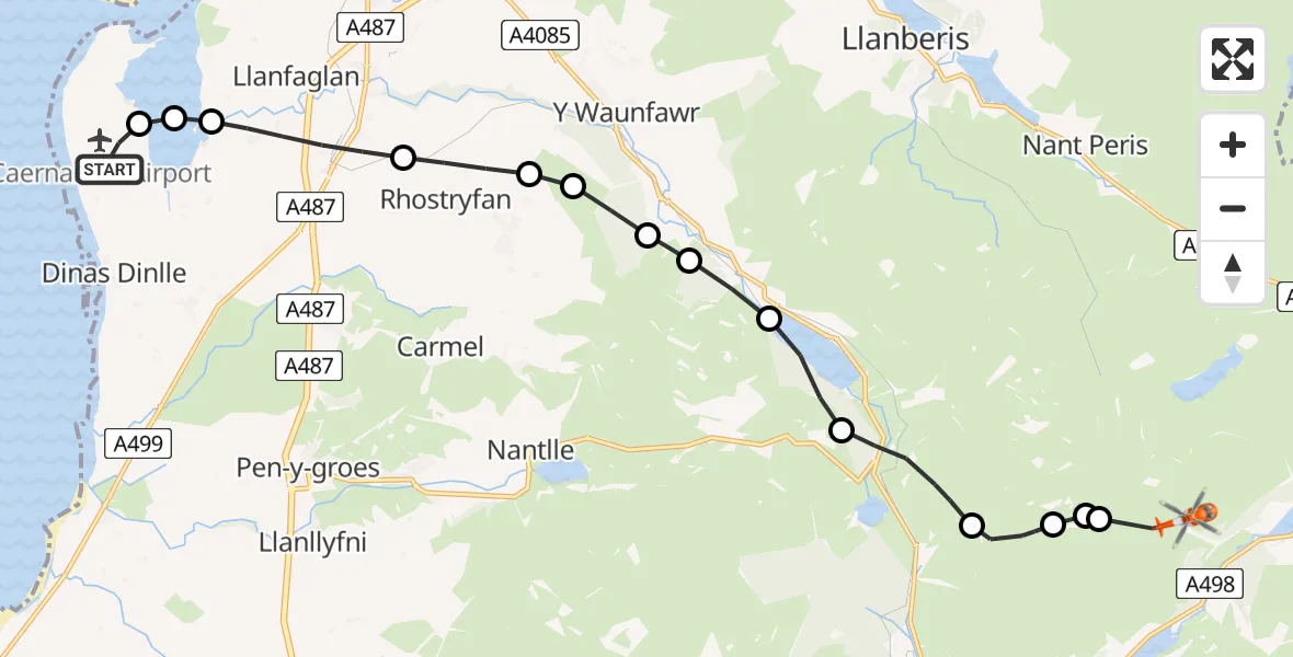
On Tuesday, 28 April 2026 at 20:58, a Coastguard Helicopter departed from Caernarfon Airport to Beddgelert. It was the Coastguard Helicopter with registration number G-RESI. The flight lasted 15 minutes. During that period, the aircraft travelled 14 miles at an average speed of 54 miles per hour at a maximum altitude of 1800 feet.

Helicopter: G-RESI
The helicopter G-RESI is used by the British Coastguard. The helicopter is deployed in search and rescue operations at sea, rescue operations involving ships or drilling platforms, patrols to prevent smuggling or piracy, environmental monitoring and disaster relief support.
Photo: Tony Melony
14 miles
1800 feet
54 mph
16 minutes
20:58
21:13

Route
Watkin Path, Gwynedd21:13
Beddgelert, Gwynedd21:12
Betws Garmon, Gwynedd21:12
Beddgelert, Gwynedd21:12
Betws Garmon, Gwynedd21:11
Rhyd-ddu, Gwynedd21:10
Betws Garmon, Gwynedd21:09
Salem, Gwynedd21:08
Betws Garmon, Gwynedd21:08
Rhosgadfan, Gwynedd21:08
Llanwnda, Gwynedd21:07
Bontnewydd, Gwynedd21:07
Llanfaglan, Gwynedd21:05
Llandwrog, Gwynedd21:05
Llanfaglan, Gwynedd21:05
Caernarfon Airport, Caernarfon20:58
Live flights
Police Helicopter on its way from Ewelme13 Jul 22:24
Today
Police Helicopter to Bournemouth Airport13 Jul 23:55
Air Ambulance Helicopter to Cardiff Heliport13 Jul 23:38
Police Helicopter to Birmingham Airport13 Jul 23:21
Police Helicopter to Irlam, Twelve Yards Road13 Jul 23:00
Flights Beddgelert
Coastguard Helicopter to Beddgelert, Pyg Track24 May 14:59
Coastguard Helicopter to Beddgelert, Pyg Track24 May 14:51
Coastguard Helicopter to Beddgelert, Pyg Track24 May 14:47
Coastguard Helicopter to Beddgelert, Pyg Track24 May 14:42
Coastguard Helicopter to Beddgelert, Crib Goch24 May 14:02
Coastguard Helicopter to Beddgelert, Crib Goch24 May 13:49
Coastguard Helicopter to Caernarfon Airport18 May 16:22
Helicopter flights on your website?
You can easily display helicopter flights on your own website. Use the embed code.
