Air Ambulance Helicopter to Egglescliffe, Urlay Nook Road
Tuesday, 28 April 2026 | 17:04 | From Shotton Colliery
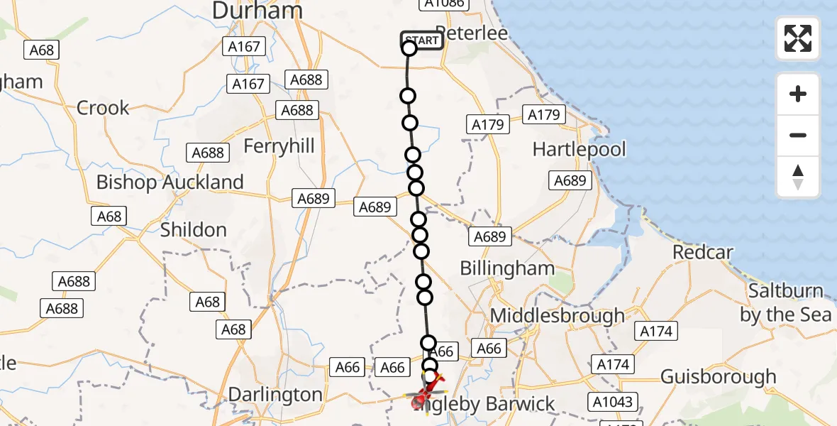
On Tuesday, 28 April 2026 at 17:04, a Air Ambulance Helicopter departed from Shotton Colliery to Egglescliffe. It was the Air Ambulance Helicopter with registration number G-NHAD. The flight lasted 7 minutes. During that period, the aircraft travelled 17 miles at an average speed of 144 miles per hour at a maximum altitude of 1075 feet.

Helicopter: G-NHAD
The helicopter G-NHAD is used as a air ambulance helicopter. The main purpose of this aircraft is to transport a Mobile Medical Team to an incident as quickly as possible, enabling the trauma doctor to provide immediate first aid on site. The aircraft is flying this flight as Air Ambulance Helicopter.
Photo: Samloynes 1
17 miles
1075 feet
144 mph
7 minutes
17:04
17:11

Route
Urlay Nook Road, Stockton-on-Tees17:11
Elton, Stockton-on-Tees17:10
Longnewton, Stockton-on-Tees17:10
Elton, Stockton-on-Tees17:10
Redmarshall, Stockton-on-Tees17:09
Carlton, Stockton-on-Tees17:09
Thorpe Thewles, Stockton-on-Tees17:08
Grindon and Thorpe Thewles, Stockton-on-Tees17:08
Wynyard, Stockton-on-Tees17:08
Sedgefield, County Durham17:07
Wingate, County Durham17:07
Fishburn, County Durham17:07
Trimdon Village, County Durham17:06
Trimdon Colliery, County Durham17:06
Wheatley Hill, County Durham17:05
Hart to Haswell Walkway, County Durham17:04
Today
Flights Egglescliffe
Air Ambulance Helicopter to Egglescliffe26 Jul 16:59
Air Ambulance Helicopter to Egglescliffe26 Jul 16:07
Air Ambulance Helicopter to Tynemouth, Pier Road26 Jul 14:56
Air Ambulance Helicopter to Seaham, Station Road24 Jul 12:28
Air Ambulance Helicopter to Egglescliffe24 Jul 09:25
Air Ambulance Helicopter to Egglescliffe23 Jul 17:31
Helicopter flights on your website?
You can easily display helicopter flights on your own website. Use the embed code.
