Air Ambulance Helicopter to Meall Buidhe, Loch Beannacharain
Tuesday, 28 April 2026 | 12:46 | From Dalcross Heliport
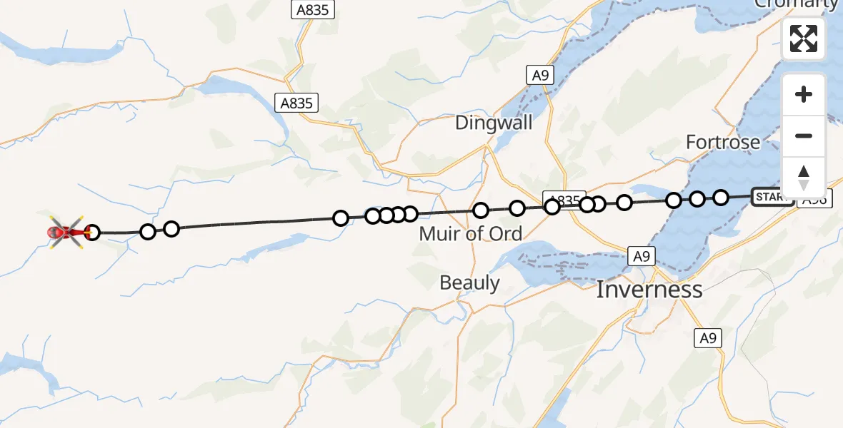
On Tuesday, 28 April 2026 at 12:46, a Air Ambulance Helicopter departed from Dalcross Heliport to Meall Buidhe. It was the Air Ambulance Helicopter with registration number G-GSAS. The flight lasted 15 minutes. During that period, the aircraft travelled 34 miles at an average speed of 137 miles per hour at a maximum altitude of 2450 feet.
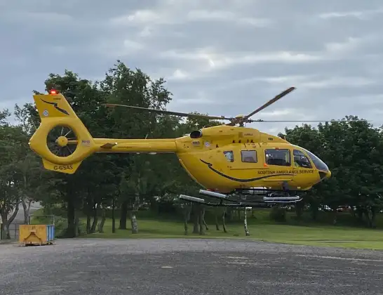
Helicopter: G-GSAS
The helicopter G-GSAS is used as a air ambulance helicopter. The main purpose of this aircraft is to transport a Mobile Medical Team to an incident as quickly as possible, enabling the trauma doctor to provide immediate first aid on site. The aircraft is flying this flight as Air Ambulance Helicopter.
Photo: Scanbus
34 miles
2450 feet
137 mph
15 minutes
12:46
13:01

Route
Meall Buidhe, Highland13:01
Loch Beannacharain, 13:01
Highland, Highland12:59
Meall Giubhais, Highland12:59
Highland, Highland12:55
Fairburn, Highland12:55
Marybank, Highland12:54
Aultgowrie, Highland12:54
Orrinside, Highland12:54
Muir of Ord, Highland12:52
Mulbuie, Highland12:52
Inverness, Highland12:51
Tore, Highland12:50
Inverness, Highland12:50
Munlochy, Highland12:50
Munlochy, Highland12:49
Inverness, Highland12:48
Avoch, Highland12:48
Fortrose, Highland12:47
Dalcross Heliport12:46
Live flights
Police Helicopter on its way from RAF Benson27 Jul 22:46
Police Helicopter on its way from Irlam27 Jul 22:40
Police Helicopter on its way from East Ardsley27 Jul 21:40
Today
Police Helicopter to Hawarden Airport27 Jul 22:37
Police Helicopter to Connah's Quay27 Jul 21:55
Air Ambulance Helicopter to Nottingham Heliport27 Jul 21:28
Air Ambulance Helicopter to RAF Northolt27 Jul 21:04
Police Helicopter to Manchester Barton Aerodrome27 Jul 21:00
Police Helicopter to Birmingham Airport27 Jul 20:59
Police Helicopter to Almondsbury Helicopter Base27 Jul 20:50
Police Helicopter to North Weald Airfield27 Jul 20:34
Air Ambulance Helicopter to Mansbridge, M2727 Jul 20:31
Helicopter flights on your website?
You can easily display helicopter flights on your own website. Use the embed code.
