Air Ambulance Helicopter to Spencers Wood, Norman Rise
Monday, 27 April 2026 | 17:36 | From RAF Benson

On Monday, 27 April 2026 at 17:36, a Air Ambulance Helicopter departed from RAF Benson to Spencers Wood. It was the Air Ambulance Helicopter with registration number G-TVLY. The flight lasted 16 minutes. During that period, the aircraft travelled 22 miles at an average speed of 85 miles per hour at a maximum altitude of 1150 feet.
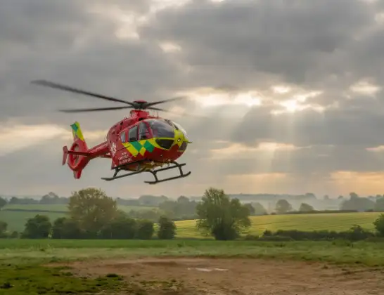
Helicopter: G-TVLY
The helicopter G-TVLY is used as a air ambulance helicopter. The main purpose of this aircraft is to transport a Mobile Medical Team to an incident as quickly as possible, enabling the trauma doctor to provide immediate first aid on site. The aircraft is flying this flight as Air Ambulance Helicopter.
Photo: Tony Melony
23 miles
1150 feet
85 mph
16 minutes
17:36
17:51

Route
Norman Rise, Wokingham17:51
Spencers Wood, Wokingham17:50
Beech Hill, West Berkshire17:50
Spencers Wood, Wokingham17:48
Beech Hill, West Berkshire17:48
Spencers Wood, Wokingham17:48
Three Mile Cross, Wokingham17:47
Reading, Reading17:45
Reading, West Berkshire17:45
Purley on Thames, West Berkshire17:45
Whitchurch-on-Thames, Oxfordshire17:44
Whitchurch Hill, Oxfordshire17:44
Woodcote, Oxfordshire17:43
Chiltern Park Aerodrome, Reading, Oxfordshire17:43
South Stoke, Oxfordshire17:42
North Stoke, Oxfordshire17:42
Stephen's Field, Oxfordshire17:41
Benson, Oxfordshire17:41
RAF Benson, Wallingford, Oxfordshire17:39
RAF Benson, Wallingford, Oxfordshire17:36
Live flights
Today
Helicopter flights on your website?
You can easily display helicopter flights on your own website. Use the embed code.
