Air Ambulance Helicopter to Dover, Approach Road
Monday, 27 April 2026 | 0:36 | From Redhill Aerodrome
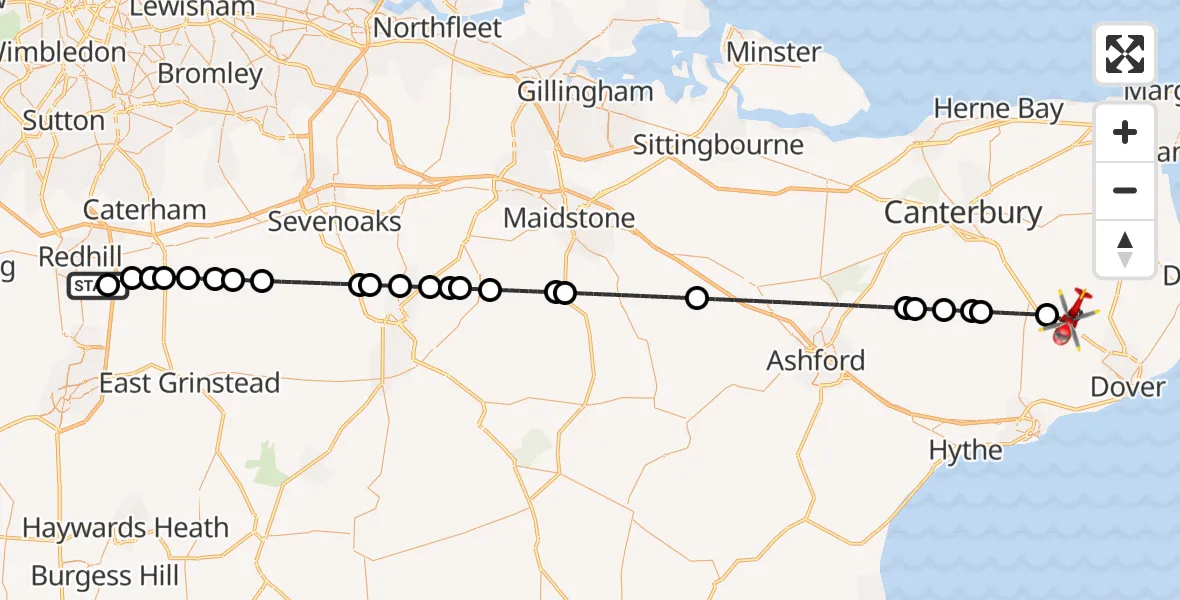
On Monday, 27 April 2026 at 0:36, a Air Ambulance Helicopter departed from Redhill Aerodrome to Dover. It was the Air Ambulance Helicopter with registration number G-KSSC. The flight lasted 34 minutes. During that period, the aircraft travelled 63 miles at an average speed of 111 miles per hour at a maximum altitude of 1100 feet.
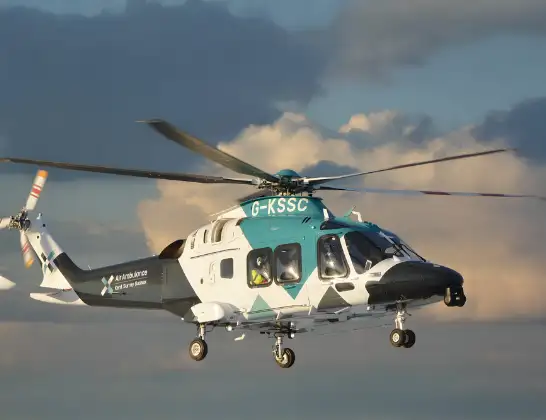
Helicopter: G-KSSC
The helicopter G-KSSC is used as a air ambulance helicopter. The main purpose of this aircraft is to transport a Mobile Medical Team to an incident as quickly as possible, enabling the trauma doctor to provide immediate first aid on site. The aircraft is flying this flight as Air Ambulance Helicopter.
Photo: Shona aakss
64 miles
1100 feet
111 mph
35 minutes
00:36
01:11

Route
Approach Road, Kent01:11
Dover, Kent01:04
Barham, Kent01:03
Bossingham, Kent01:02
Stelling Minnis, Kent01:02
Waltham, Kent01:01
Crundale, Kent01:01
Ashford, Kent00:55
Maidstone, Kent00:52
Rankins Farm Airfield, Maidstone, Kent00:51
Maidstone, Kent00:50
East Peckham, Kent00:49
Golden Green, Kent00:49
Hadlow, Kent00:48
Tonbridge, Kent00:47
Hildenborough, Kent00:47
Tonbridge and Malling, Kent00:46
Sevenoaks, Kent00:44
Edenbridge, Kent00:43
Merle Common, Surrey00:43
Crowhurst, Surrey00:42
South Godstone, Surrey00:41
Blindley Heath, Surrey00:41
Tandridge, Surrey00:40
Coopers Hill Road, Surrey00:39
South Nutfield, Surrey00:39
Redhill Aerodrome, Redhill, Surrey00:36
Live flights
Today
Flights Dover
Coastguard Drone to Dover, Langdon Stairs8 Jun 10:07
Coastguard Drone to Dover, Langdon Stairs8 Jun 04:48
Coastguard Drone to English Channel8 Jun 01:52
Coastguard Drone to Dover, Prescott Close6 Jun 04:57
Coastguard Drone to English Channel6 Jun 02:57
Coastguard Helicopter to Manston Airport4 Jun 16:02
Coastguard Drone to Swingate Airfield29 May 06:45
Coastguard Drone to Dover, Sandwich Road27 May 11:11
Helicopter flights on your website?
You can easily display helicopter flights on your own website. Use the embed code.
