Police Helicopter to Redhill Aerodrome
Sunday, 26 April 2026 | 20:47 | From Tandridge
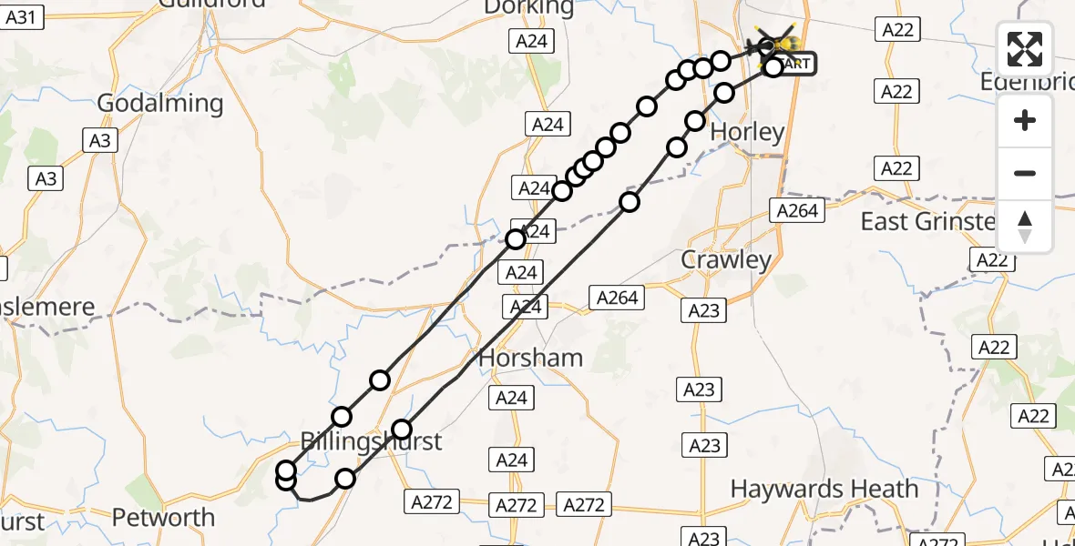
On Sunday, 26 April 2026 at 20:47, a Police Helicopter departed from Tandridge to Redhill Aerodrome. It was the Police Helicopter with registration number G-POLH. The flight lasted 21 minutes. During that period, the aircraft travelled 45 miles at an average speed of 132 miles per hour at a maximum altitude of 1200 feet.
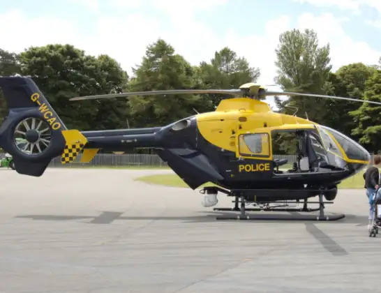
Helicopter: G-POLH
The helicopter G-POLH is used by the British police. The helicopter is deployed in pursuits, missing persons cases and other incidents where a helicopter provides added value.
Photo: Arpingstone
46 miles
1200 feet
132 mph
21 minutes
20:47
21:08

Route
Redhill Aerodrome, Redhill, Surrey21:08
Redhill Aerodrome, Redhill, Surrey21:08
Salfords, Surrey21:06
Reigate and Banstead, Surrey21:06
Norwood Hill, Surrey21:05
Nalderswood, Surrey21:05
Norwood Hill, Surrey21:04
Mole Valley, Surrey21:04
Newdigate, Surrey21:04
Mole Valley, Surrey21:03
Newdigate, Surrey21:03
Mole Valley, Surrey21:03
Capel, Surrey21:03
Mole Valley, Surrey21:02
Horsham, West Sussex20:59
Billingshurst, West Sussex20:58
Wisborough Green, West Sussex20:57
Chichester, West Sussex20:57
Horsham, West Sussex20:56
Billingshurst, West Sussex20:55
Horsham, West Sussex20:50
Charlwood, Surrey20:49
Norwood Hill, Surrey20:49
Reigate and Banstead, Surrey20:48
Salfords, Surrey20:48
Hatch Lane, Surrey20:47
Live flights
Today
Flights Tandridge
Police Helicopter to Salfords, Cross Oak Lane31 May 19:55
Police Helicopter to Tandridge, Crab Hill Lane30 May 18:40
Police Helicopter to Tandridge, Crab Hill Lane29 May 16:24
Police Helicopter to Tandridge, Moats Lane29 May 15:09
Police Helicopter to Tandridge, Crab Hill Lane23 May 00:50
Helicopter flights on your website?
You can easily display helicopter flights on your own website. Use the embed code.
