Police Helicopter to Newcastle International Airport
Sunday, 26 April 2026 | 10:40 | From Newcastle International Airport
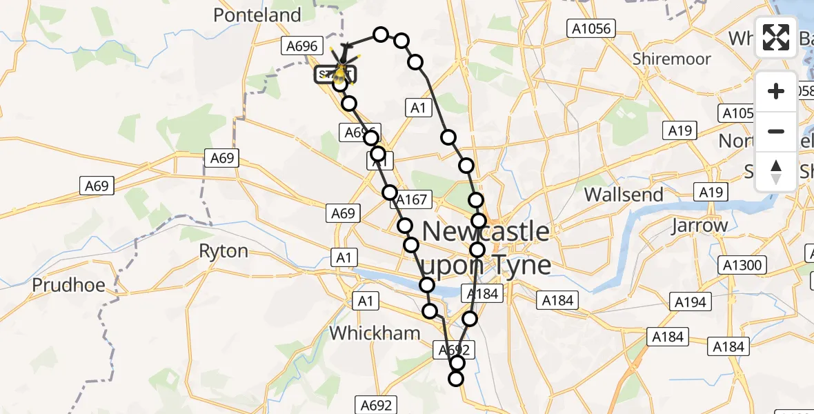
On Sunday, 26 April 2026 at 10:40, a Police Helicopter departed from Newcastle International Airport to Newcastle International Airport. It was the Police Helicopter with registration number G-POLA. The flight lasted 8 minutes. During that period, the aircraft travelled 18 miles at an average speed of 129 miles per hour at a maximum altitude of 975 feet.
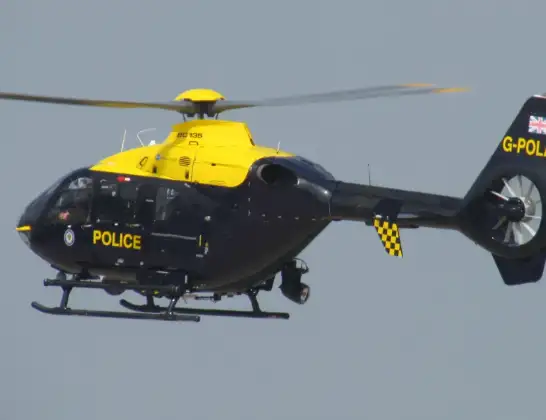
Helicopter: G-POLA
The helicopter G-POLA is used by the British police. The helicopter is deployed in pursuits, missing persons cases and other incidents where a helicopter provides added value.
Photo: ozz13x
18 miles
975 feet
129 mph
9 minutes
10:40
10:48

Route
Newcastle International Airport, Newcastle upon Tyne, Tyne and Wear10:48
Newcastle International Airport, Newcastle upon Tyne, Tyne and Wear10:48
Dinnington, Newcastle upon Tyne10:47
Newcastle upon Tyne, Newcastle upon Tyne10:47
Coxlodge, Newcastle upon Tyne10:46
Gosforth, Newcastle upon Tyne10:46
Cowgate, Newcastle upon Tyne10:46
Spital Tongues, Newcastle upon Tyne10:46
Grainger Town, Newcastle upon Tyne10:45
Gateshead, Gateshead10:45
Whickham, Gateshead10:44
Birtley, Gateshead10:44
Whickham, Gateshead10:43
Elswick, Newcastle upon Tyne10:43
Fenham, Newcastle upon Tyne10:43
Elswick, Newcastle upon Tyne10:42
Cowgate, Newcastle upon Tyne10:42
Blakelaw, Newcastle upon Tyne10:41
Callerton, Newcastle upon Tyne10:41
Woolsington, Newcastle upon Tyne10:41
Callerton, Newcastle upon Tyne10:40
Airport Freightway, Tyne and Wear - Newcastle upon Tyne10:40
Live flights
Today
Helicopter flights on your website?
You can easily display helicopter flights on your own website. Use the embed code.
