Air Ambulance Helicopter to Upper Strensham, Strensham Road
Saturday, 25 April 2026 | 20:24 | From Hill Croome
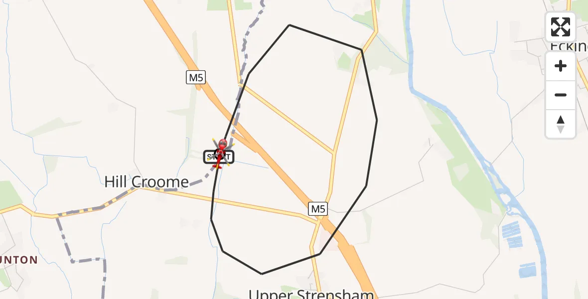
On Saturday, 25 April 2026 at 20:24, a Air Ambulance Helicopter departed from Hill Croome to Upper Strensham. It was the Air Ambulance Helicopter with registration number G-OMAA. The flight lasted 5 minutes. During that period, the aircraft travelled 3 miles at an average speed of 40 miles per hour at a maximum altitude of 775 feet.
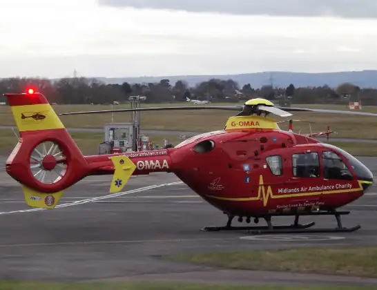
Helicopter: G-OMAA
The helicopter G-OMAA is used as a air ambulance helicopter. The main purpose of this aircraft is to transport a Mobile Medical Team to an incident as quickly as possible, enabling the trauma doctor to provide immediate first aid on site. The aircraft is flying this flight as Air Ambulance Helicopter.
Photo: James from Cheltenham, Gloucestershire
4 miles
775 feet
40 mph
6 minutes
20:24
20:29

Route
Upper Strensham, Worcestershire20:29
Strensham Road, West Midlands - Worcestershire20:28
Baughton Lane, West Midlands - Worcestershire20:26
Upper Strensham, Worcestershire20:24
Hill Croome, West Midlands - Worcestershire20:24
Live flights
Police Helicopter on its way from RAF Benson12 Jul 22:54
Police Helicopter on its way from Dundrod12 Jul 22:50
Police Helicopter on its way from East Ardsley12 Jul 22:44
Today
Air Ambulance Helicopter to Glasgow Airport12 Jul 22:48
Air Ambulance Helicopter to Norwich Airport12 Jul 22:27
Air Ambulance Helicopter to Northrepps Aerodrome12 Jul 22:23
Police Helicopter to Harborough, Sulby Road12 Jul 22:20
Air Ambulance Helicopter to Derriford Hospital12 Jul 22:12
Police Helicopter to Manchester Barton Aerodrome12 Jul 22:11
Air Ambulance Helicopter to Northrepps Aerodrome12 Jul 22:03
Helicopter flights on your website?
You can easily display helicopter flights on your own website. Use the embed code.
