Air Ambulance Helicopter to Ennerdale and Kinniside, High Level Route
Saturday, 25 April 2026 | 16:13 | From Penrith
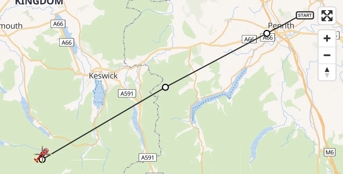
On Saturday, 25 April 2026 at 16:13, a Air Ambulance Helicopter departed from Penrith to Ennerdale and Kinniside. It was the Air Ambulance Helicopter with registration number G-NHAE. The flight lasted 12 minutes. During that period, the aircraft travelled 27 miles at an average speed of 131 miles per hour at a maximum altitude of 2675 feet.
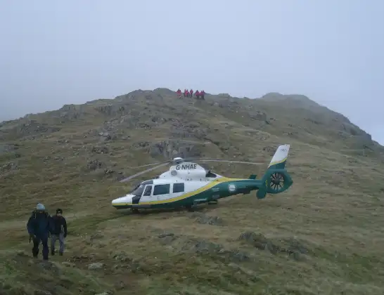
Helicopter: G-NHAE
The helicopter G-NHAE is used as a air ambulance helicopter. The main purpose of this aircraft is to transport a Mobile Medical Team to an incident as quickly as possible, enabling the trauma doctor to provide immediate first aid on site. The aircraft is flying this flight as Air Ambulance Helicopter.
Photo: Michael Earnshaw
27 miles
2675 feet
131 mph
13 minutes
16:13
16:25

Route
High Level Route, Cumberland16:25
Ennerdale and Kinniside, Cumberland16:24
Matterdale, Westmorland and Furness16:18
Stainton, Westmorland and Furness16:14
A686, Westmorland and Furness16:13
Live flights
Today
Flights Penrith
Air Ambulance Helicopter to Greysouthen21 Jul 18:49
Air Ambulance Helicopter to Pennington18 Jul 18:00
Air Ambulance Helicopter to Langwathby18 Jul 15:48
Air Ambulance Helicopter to Penrith, A68618 Jul 15:19
Air Ambulance Helicopter to Penrith, A68614 Jul 14:59
Air Ambulance Helicopter to Stainton14 Jul 14:43
Air Ambulance Helicopter to Greystoke13 Jul 11:19
Air Ambulance Helicopter to Langwathby12 Jul 16:53
Helicopter flights on your website?
You can easily display helicopter flights on your own website. Use the embed code.
