Air Ambulance Helicopter to Sheffield Northern Hospital
Saturday, 25 April 2026 | 14:37 | From High Peak
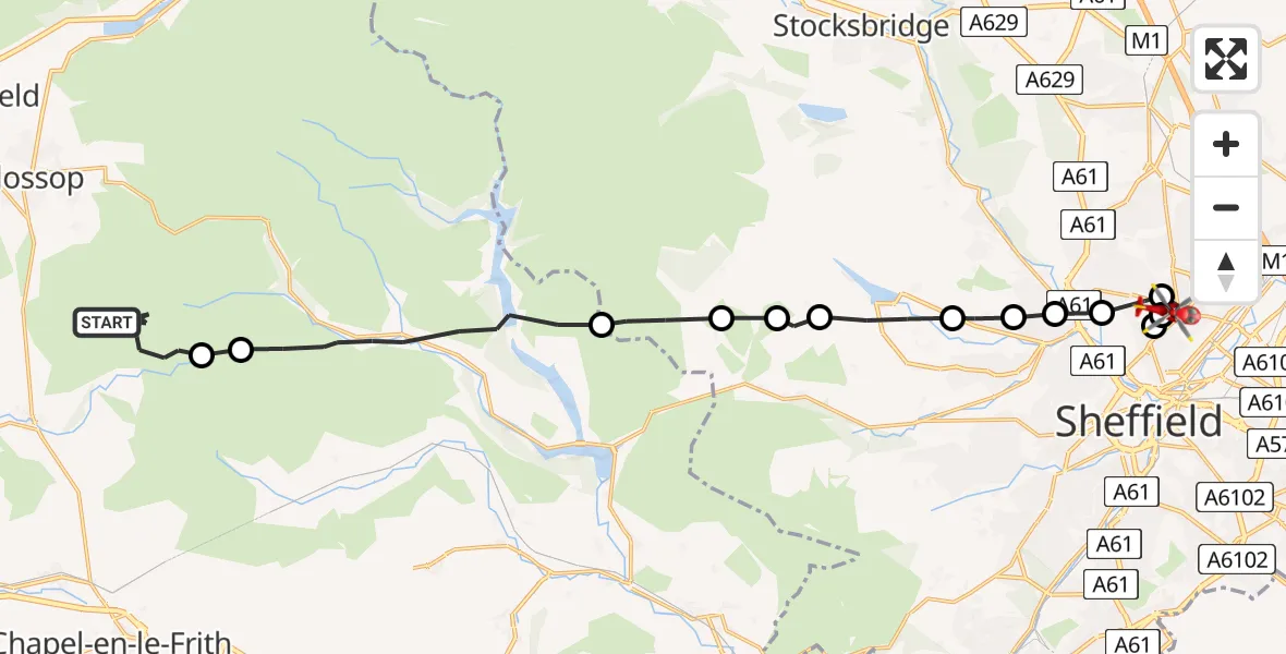
On Saturday, 25 April 2026 at 14:37, a Air Ambulance Helicopter departed from High Peak to Sheffield Northern Hospital. It was the Air Ambulance Helicopter with registration number G-DRLA. The flight lasted 11 minutes. During that period, the aircraft travelled 22 miles at an average speed of 115 miles per hour at a maximum altitude of 2425 feet.
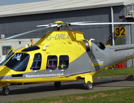
Helicopter: G-DRLA
The helicopter G-DRLA is used as an ambulance helicopter. The helicopter is equipped with a stretcher for transporting patients. The helicopter is often used to transport to hospitals.
Photo: Alec Wilson
22 miles
2425 feet
115 mph
12 minutes
14:37
14:49

Route
Sheffield Northern Hospital, Sheffield14:49
Pitsmoor, Sheffield14:48
Southey, Sheffield14:48
Pitsmoor, Sheffield14:47
Southey, Sheffield14:46
Middlewood, Sheffield14:46
Wisewood, Sheffield14:46
Storrs, Sheffield14:45
Dungworth, Sheffield14:44
Low Bradfield, Sheffield14:44
Bradfield, Sheffield14:44
Bradfield, Derbyshire14:43
High Peak, Derbyshire14:40
Hayfield, Derbyshire14:40
Snake Path, Derbyshire14:39
High Peak, Derbyshire14:37
Live flights
Today
Helicopter flights on your website?
You can easily display helicopter flights on your own website. Use the embed code.
